Cof Cymru: National Historic Assets of Wales · Wales
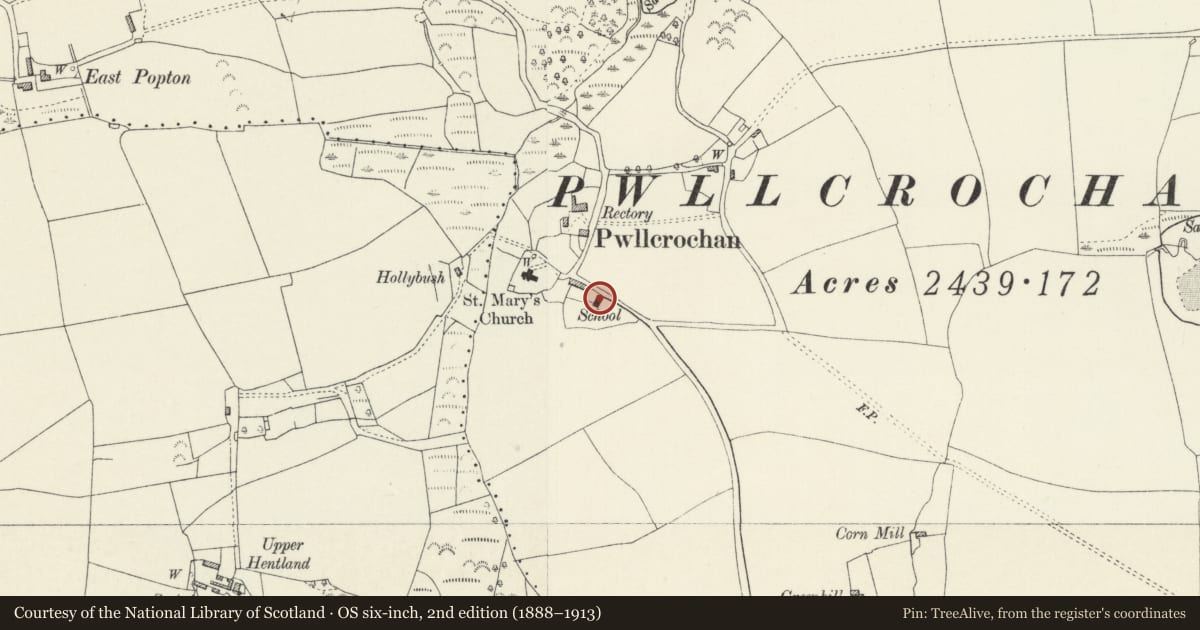
Former National School Building
Angle, Pembrokeshire, Wales
A Grade II listed building in Pwllcrochan, Angle, Pembrokeshire, designated on 29 September 1993.
The record
- Designation
- Listed building, Grade II
- Broad class
- Education
- Date of designation
- 29 September 1993
- Locality
- Pwllcrochan
- Community
- Angle
- Unitary authority
- Pembrokeshire
- Country
- Wales
- Coordinates
- 51.68378, -5.00806
- Cadw reference
- 6588
Slide toward Today to fade the historical sheet and see the modern map underneath.
David Rumsey Map Collection, Stanford LibrariesDavid Rumsey Map Collection, Stanford LibrariesDavid Rumsey Map Collection, Stanford LibrariesDavid Rumsey Map Collection, Stanford LibrariesDavid Rumsey Map Collection, Stanford Libraries
5 historical maps cover this location, the earliest the 1636 map "Cornubia : Devonia, Somersetus, Dorcestria, Wiltonia, Glocestria ..." (David Rumsey Map Collection, Stanford Libraries).
Historical maps covering this location
- 1636 · Cornubia : Devonia, Somersetus, Dorcestria, Wiltonia, Glocestria ... (David Rumsey Map Collection, Stanford Libraries)
- 1830 · V.3:11-15:XV. Britisches Reich. A. Kon: England. b. Frstenthum Wales: Shire: 37-40 (David Rumsey Map Collection, Stanford Libraries)
- 1865 · England and Wales. England No. 6. (David Rumsey Map Collection, Stanford Libraries)
- 1891 · Sheet 10. Ordnance Survey of England and Wales. . (David Rumsey Map Collection, Stanford Libraries)
- 1901 · Sheet 13. (David Rumsey Map Collection, Stanford Libraries)
Cadw's description
Location
Situated on S side of lane from Wallaston Cross, some 100m ESE of church.
Exterior
1861 former schoolroom in squared grey limestone with slate eaves roof, coped shouldered N gable and bellcote. Single storey. N end has 3-light mullion and transom timber window with small-paned glazing, chamfered reveal, stone sill and moulded stone hoodmould. Bellcote is corbelled with sides stepped in and single pointed bell opening. Slate date plaque. Raised plinth. W side has two 3-light timber mullioned windows. S end has lean-to porch with pointed door. N side has chimney as on the 1851 school at Rhoscrowther, chamfered sides and squared base and cap.
Reason for designation
Included as good small-scale example of a rural school building which groups with former parish church in the centre of a scattered community.
Nearby in the register
- Former Church of Saint MaryReligious, Ritual and Funeraryunder 1 mi
- Enclosure & Earthworks at Lewiston HallPromontory Fort- coastalunder 1 mi
- Garden Arch at Old HenllanGardens, Parks and Urban Spacesunder 1 mi
- Stone Building (now as a Barn) at Old HenllanDomesticunder 1 mi
Other entries of the same register within about three miles of this one, by straight line.