Cof Cymru: National Historic Assets of Wales · Wales
Images Lodge and adjoining Gatepiers to former Driveway to Orielton
Hundleton, Pembrokeshire, Wales
A Grade II listed building in Hundleton, Pembrokeshire, designated on 14 May 1970.
The record
- Designation
- Listed building, Grade II
- Broad class
- Domestic
- Date of designation
- 14 May 1970
- Community
- Hundleton
- Unitary authority
- Pembrokeshire
- Country
- Wales
- Coordinates
- 51.65849, -4.96939
- Cadw reference
- 6584
Slide toward Today to fade the historical sheet and see the modern map underneath.
David Rumsey Map Collection, Stanford LibrariesDavid Rumsey Map Collection, Stanford LibrariesDavid Rumsey Map Collection, Stanford LibrariesDavid Rumsey Map Collection, Stanford LibrariesDavid Rumsey Map Collection, Stanford Libraries
5 historical maps cover this location, the earliest the 1636 map "Cornubia : Devonia, Somersetus, Dorcestria, Wiltonia, Glocestria ..." (David Rumsey Map Collection, Stanford Libraries).
Historical maps covering this location
- 1636 · Cornubia : Devonia, Somersetus, Dorcestria, Wiltonia, Glocestria ... (David Rumsey Map Collection, Stanford Libraries)
- 1865 · England and Wales. England No. 6. (David Rumsey Map Collection, Stanford Libraries)
- 1891 · Sheet 10. Ordnance Survey of England and Wales. . (David Rumsey Map Collection, Stanford Libraries)
- 1898 · 245 Pembroke (Hills) (David Rumsey Map Collection, Stanford Libraries)
- 1901 · Sheet 13. (David Rumsey Map Collection, Stanford Libraries)
Cadw's description
Location
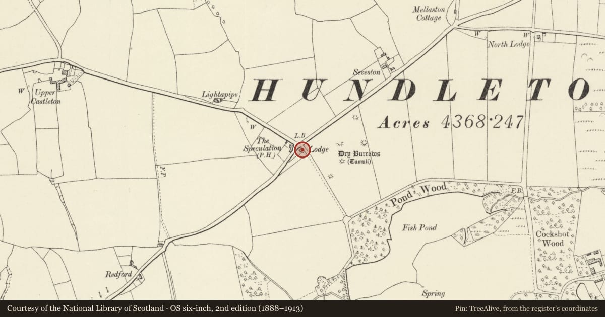
Situated at junction of B 4320 with minor road to Castlemartin, opposite The Speculation Inn.
Exterior
Earlier C19 lodge to Orielton estate, near identical to Rose Lodge, Bowett Lane. Roughcast with grouted slate, hipped roof and centre stone stack. Single storey, double fronted with dentilled eaves cornice. Stone hoodmoulds over paired 8-pane windows each side and centre door in added glazed porch. Similar window in N end wall to road. Windows are small, flat-headed but with rounded head to each light.
To NE are two grey stone gatepiers with plinths, plain top bands and concave square caps, one with cast metal cherub statue, the other missing (under repair 1992).
The cherubs together with two now on the Clock Tower, Pembroke, were formerly on the main house at Orielton.
Reason for designation
Group value with other listed items in grounds of Orielton Field Centre.
Nearby in the register
- Dry Burrows Round BarrowsRound Barrowunder 1 mi
- Round Barrow 400m N of West OrieltonRound Barrowunder 1 mi
- West LodgeDomesticunder 1 mi
- Former Stable Court of 2 Ranges to NDomesticunder 1 mi
Other entries of the same register within about three miles of this one, by straight line.