Cof Cymru: National Historic Assets of Wales · Wales
West Lodge
Hundleton, Pembrokeshire, Wales
A Grade II listed building in Hundleton, Pembrokeshire, designated on 29 September 1993.
The record
- Designation
- Listed building, Grade II
- Broad class
- Domestic
- Date of designation
- 29 September 1993
- Community
- Hundleton
- Unitary authority
- Pembrokeshire
- Country
- Wales
- Coordinates
- 51.66151, -4.95928
- Cadw reference
- 6583
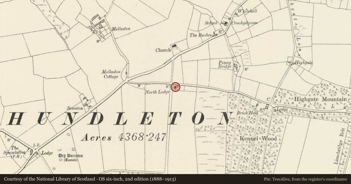
Slide toward Today to fade the historical sheet and see the modern map underneath.
David Rumsey Map Collection, Stanford LibrariesDavid Rumsey Map Collection, Stanford LibrariesDavid Rumsey Map Collection, Stanford LibrariesDavid Rumsey Map Collection, Stanford LibrariesDavid Rumsey Map Collection, Stanford Libraries
5 historical maps cover this location, the earliest the 1636 map "Cornubia : Devonia, Somersetus, Dorcestria, Wiltonia, Glocestria ..." (David Rumsey Map Collection, Stanford Libraries).
Historical maps covering this location
- 1636 · Cornubia : Devonia, Somersetus, Dorcestria, Wiltonia, Glocestria ... (David Rumsey Map Collection, Stanford Libraries)
- 1865 · England and Wales. England No. 6. (David Rumsey Map Collection, Stanford Libraries)
- 1891 · Sheet 10. Ordnance Survey of England and Wales. . (David Rumsey Map Collection, Stanford Libraries)
- 1898 · 245 Pembroke (Hills) (David Rumsey Map Collection, Stanford Libraries)
- 1901 · Sheet 13. (David Rumsey Map Collection, Stanford Libraries)
Cadw's description
Location
Situated some 300m E of junction with B4320, at head of drive to West Orielton Farm.
Exterior
Earlier C19 Orielton estate lodge, nearly identical to ruined Gamekeeper's Cottage at West Orielton. Whitewashed render with deep-eaved slate roof and centre ridge stack, formerly with three brick octagonal stacks, of which one rendered stem survives. Single-storey, T-plan, with double fronted facade and Gothick detail. Shallow pedimental gable over centre. Paired pointed windows each side and matching paired overlight above door, each recessed in matching painted stucco surrounds (probably brick as at Gamekeeper's Cottage), with rusticated sides. Small-paned windows with Y-tracery heads. Heavy painted stone sills with reeded leading edge. Ledged door. Painted angle quoins. Rear wing has rendered octagonal E end stack.
Reason for designation
Group with other listed items in grounds of Orielton Field Centre.
Nearby in the register
- Walls of Two Walled Gardens including Dog Kennels at Brick HallDomesticunder 1 mi
- Brick HallDomesticunder 1 mi
- North LodgeDomesticunder 1 mi
- Dry Burrows Round BarrowsRound Barrowunder 1 mi
Other entries of the same register within about three miles of this one, by straight line.