Cof Cymru: National Historic Assets of Wales · Wales
Walls of Two Walled Gardens including Dog Kennels at Brick Hall
Hundleton, Pembrokeshire, Wales
A Grade II listed building in Hundleton, Pembrokeshire, designated on 31 August 1993.
The record
- Designation
- Listed building, Grade II
- Broad class
- Domestic
- Date of designation
- 31 August 1993
- Community
- Hundleton
- Unitary authority
- Pembrokeshire
- Country
- Wales
- Coordinates
- 51.66072, -4.95322
- Cadw reference
- 6582
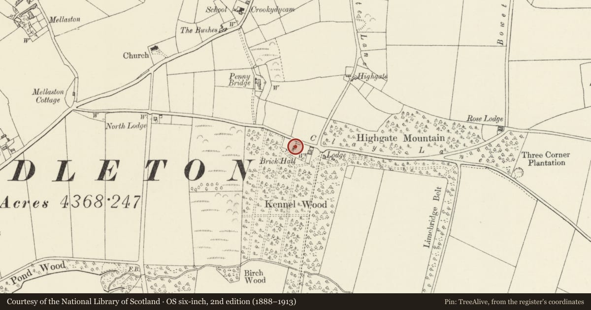
Slide toward Today to fade the historical sheet and see the modern map underneath.
David Rumsey Map Collection, Stanford LibrariesDavid Rumsey Map Collection, Stanford LibrariesDavid Rumsey Map Collection, Stanford LibrariesDavid Rumsey Map Collection, Stanford LibrariesDavid Rumsey Map Collection, Stanford Libraries
5 historical maps cover this location, the earliest the 1636 map "Cornubia : Devonia, Somersetus, Dorcestria, Wiltonia, Glocestria ..." (David Rumsey Map Collection, Stanford Libraries).
Historical maps covering this location
- 1636 · Cornubia : Devonia, Somersetus, Dorcestria, Wiltonia, Glocestria ... (David Rumsey Map Collection, Stanford Libraries)
- 1865 · England and Wales. England No. 6. (David Rumsey Map Collection, Stanford Libraries)
- 1891 · Sheet 10. Ordnance Survey of England and Wales. . (David Rumsey Map Collection, Stanford Libraries)
- 1898 · 245 Pembroke (Hills) (David Rumsey Map Collection, Stanford Libraries)
- 1901 · Sheet 13. (David Rumsey Map Collection, Stanford Libraries)
Cadw's description
Location
Situated immediately S of road, and mostly to W of Brick Hall which stands within the E walled garden.
History
Uncertain date, possibly C18 or early C19.
Exterior
Rubble stone garden walls enclosing two large, roughly square areas, the larger area to E has the house at NE corner, with small walled yard behind. On W wall are openings to lean-to C19 dog kennels, two doors through and a front enclosure of iron screen on low base of massive dressed stones. Second garden, to W, has lean-to pig-sty on outer S wall and lean-to former cow-house.
Reason for designation
Group value with Brick Hall and other listed items in the grounds of Orielton Field Centre; the North Lodge lies 50m to east.
Nearby in the register
- Brick HallDomesticunder 1 mi
- North LodgeDomesticunder 1 mi
- West LodgeDomesticunder 1 mi
- Orielton GardensDomesticunder 1 mi
Other entries of the same register within about three miles of this one, by straight line.