Cof Cymru: National Historic Assets of Wales · Wales
Coach House at Blackaldern
Narberth, Pembrokeshire, Wales
A Grade II listed building in Blackaldern, Narberth, Pembrokeshire, designated on 17 May 1988.
The record
- Designation
- Listed building, Grade II
- Broad class
- Domestic
- Date of designation
- 17 May 1988
- Locality
- Blackaldern
- Community
- Narberth
- Unitary authority
- Pembrokeshire
- Country
- Wales
- Coordinates
- 51.79480, -4.72860
- Cadw reference
- 6525
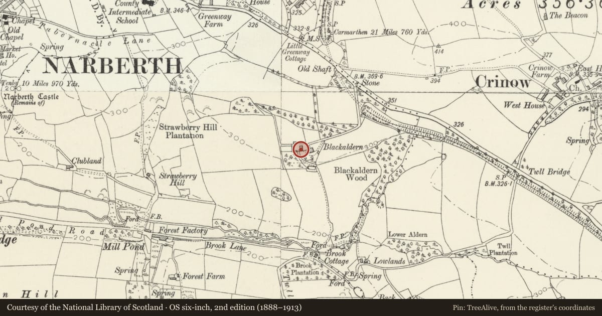
Slide toward Today to fade the historical sheet and see the modern map underneath.
David Rumsey Map Collection, Stanford LibrariesDavid Rumsey Map Collection, Stanford LibrariesDavid Rumsey Map Collection, Stanford LibrariesDavid Rumsey Map Collection, Stanford LibrariesDavid Rumsey Map Collection, Stanford Libraries
5 historical maps cover this location, the earliest the 1636 map "Cornubia : Devonia, Somersetus, Dorcestria, Wiltonia, Glocestria ..." (David Rumsey Map Collection, Stanford Libraries).
Historical maps covering this location
- 1636 · Cornubia : Devonia, Somersetus, Dorcestria, Wiltonia, Glocestria ... (David Rumsey Map Collection, Stanford Libraries)
- 1830 · V.3:11-15:XV. Britisches Reich. A. Kon: England. b. Frstenthum Wales: Shire: 37-40 (David Rumsey Map Collection, Stanford Libraries)
- 1891 · Sheet 10. Ordnance Survey of England and Wales. . (David Rumsey Map Collection, Stanford Libraries)
- 1898 · 228 Haverfordwest (Hills) (David Rumsey Map Collection, Stanford Libraries)
- 1901 · Sheet 13. (David Rumsey Map Collection, Stanford Libraries)
Cadw's description
Location
Situated beyond the house at the end of a long drive leading from the B4314 some 300 yds SE of the junction with Kiln Park Road.
Exterior
Early-mid C19. Lofted coach house and stable block. Limewashed rubble masonry. Later slate roof, moderate pitch, plain close eaves.
2 windows set under eaves, small panes retained to left.
2 broad segmental arched coach entrances to ground floor right. Stone voussoirs, modern doors. Split stable door to centre; 2 crossed glazing bar windows to left, cambered brick headed arches.
Steps to recessed round arched doorway in left end elevation; brick voussoirs, plank door. Loft door with dripstone to right gable end. Continuous outshot to rear with doorway and small window in each end wall.
Reason for designation
Group value - contemporary with original house.
Nearby in the register
- BlackaldernDomesticunder 1 mi
- Parish Boundary StoneCivilunder 1 mi
- MilestoneTransportunder 1 mi
- Stable adjoining Greenway FarmDomesticunder 1 mi
Other entries of the same register within about three miles of this one, by straight line.