Cof Cymru: National Historic Assets of Wales · Wales
Schoolroom to Tabernacle United Reformed Church
Narberth, Pembrokeshire, Wales
A Grade II listed building in Narberth, Pembrokeshire, designated on 17 May 1988.
The record
- Designation
- Listed building, Grade II
- Broad class
- Religious, Ritual and Funerary
- Date of designation
- 17 May 1988
- Community
- Narberth
- Unitary authority
- Pembrokeshire
- Country
- Wales
- Coordinates
- 51.79815, -4.74113
- Cadw reference
- 6523
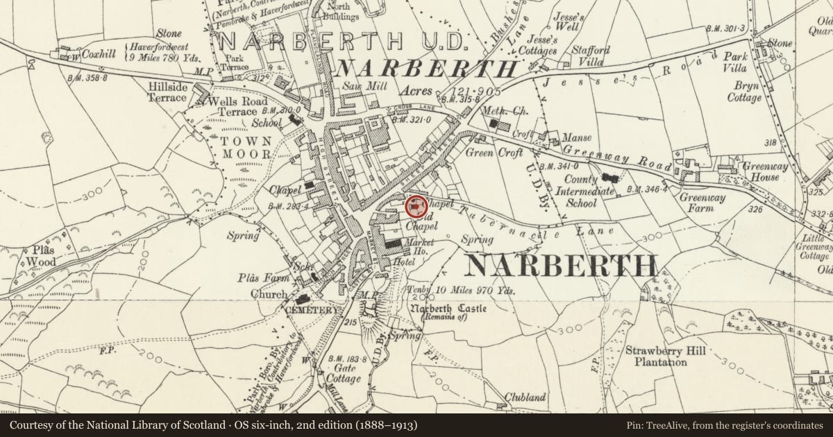
Slide toward Today to fade the historical sheet and see the modern map underneath.
David Rumsey Map Collection, Stanford LibrariesDavid Rumsey Map Collection, Stanford LibrariesDavid Rumsey Map Collection, Stanford LibrariesDavid Rumsey Map Collection, Stanford LibrariesDavid Rumsey Map Collection, Stanford Libraries
5 historical maps cover this location, the earliest the 1636 map "Cornubia : Devonia, Somersetus, Dorcestria, Wiltonia, Glocestria ..." (David Rumsey Map Collection, Stanford Libraries).
Historical maps covering this location
- 1636 · Cornubia : Devonia, Somersetus, Dorcestria, Wiltonia, Glocestria ... (David Rumsey Map Collection, Stanford Libraries)
- 1830 · V.3:11-15:XV. Britisches Reich. A. Kon: England. b. Frstenthum Wales: Shire: 37-40 (David Rumsey Map Collection, Stanford Libraries)
- 1891 · Sheet 10. Ordnance Survey of England and Wales. . (David Rumsey Map Collection, Stanford Libraries)
- 1898 · 228 Haverfordwest (Hills) (David Rumsey Map Collection, Stanford Libraries)
- 1901 · Sheet 13. (David Rumsey Map Collection, Stanford Libraries)
Cadw's description
Location
Situated adjacent to the chapel down the narrow lane by its front.
Exterior
Early-mid C19. Formerly the Wesleyan Methodist Chapel with a burial ground downslope of it. Gable end on to the lane. Random rubble masonry formerly whitewashed. Slate hung to S and rear elevations. Later C19, moderately pitched slate roof, oversailing eaves, plain bargeboards.
2 windows to 1sr floor, single light with crossed glazing bars, brick voussoirs. Former doorway obscured by later brick privy to ground floor.
Single 12 pane sash window to N side at 1st floor level, 2 similar windows to ground floor, plain reveals, stone lintels. Modern corridor abutting links schoolroom to chapel. Two blocked windows to rear elevation, further modern accretions.
Interior
Interior altered in later C19 to use as schoolrooms.
Reason for designation
Group value with the Tabernacle Church and No 61 St James Street.
Nearby in the register
- Tabernacle United Reformed ChurchReligious, Ritual and Funeraryunder 1 mi
- Annexe adjoining No.61 (Llwynon)Domesticunder 1 mi
- LlwynonDomesticunder 1 mi
- G.Badham & SonsCommercialunder 1 mi
Other entries of the same register within about three miles of this one, by straight line.