Cof Cymru: National Historic Assets of Wales · Wales
Tabernacle United Reformed Church
Narberth, Pembrokeshire, Wales
A Grade II listed building in Narberth, Pembrokeshire, designated on 17 May 1988.
The record
- Designation
- Listed building, Grade II
- Broad class
- Religious, Ritual and Funerary
- Date of designation
- 17 May 1988
- Community
- Narberth
- Unitary authority
- Pembrokeshire
- Country
- Wales
- Coordinates
- 51.79832, -4.74118
- Cadw reference
- 6522
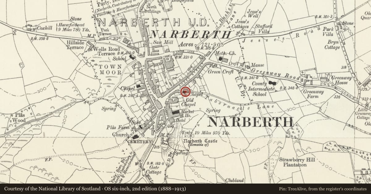
Slide toward Today to fade the historical sheet and see the modern map underneath.
David Rumsey Map Collection, Stanford LibrariesDavid Rumsey Map Collection, Stanford LibrariesDavid Rumsey Map Collection, Stanford LibrariesDavid Rumsey Map Collection, Stanford LibrariesDavid Rumsey Map Collection, Stanford Libraries
5 historical maps cover this location, the earliest the 1636 map "Cornubia : Devonia, Somersetus, Dorcestria, Wiltonia, Glocestria ..." (David Rumsey Map Collection, Stanford Libraries).
Historical maps covering this location
- 1636 · Cornubia : Devonia, Somersetus, Dorcestria, Wiltonia, Glocestria ... (David Rumsey Map Collection, Stanford Libraries)
- 1830 · V.3:11-15:XV. Britisches Reich. A. Kon: England. b. Frstenthum Wales: Shire: 37-40 (David Rumsey Map Collection, Stanford Libraries)
- 1891 · Sheet 10. Ordnance Survey of England and Wales. . (David Rumsey Map Collection, Stanford Libraries)
- 1898 · 228 Haverfordwest (Hills) (David Rumsey Map Collection, Stanford Libraries)
- 1901 · Sheet 13. (David Rumsey Map Collection, Stanford Libraries)
Cadw's description
Location
Situated behind a railed forecourt just in from St James Street.
Exterior
1858. Built as a Wesleyan Methodist Chapel. 3 bay classical front. Coarse plaster on rubble, gently pitched slate roof. Pediment with roundel bearing date 1858, numbers individually inset diagonally. Plain frieze, simple architrave. 4 Tuscan pilasters, outer ones set in from corners. Deep plinth. Tall round arched windows to outer bays. Central mullion, transomed into 6 lights, lead cames. Plain architraves, stone sills. Similar 2 light window over central round arched doorway cutting through plinth, plain architrave. Bisected semicircular fanlight over panelled double doors.
Plain 3 window side elevations; similar fenestration to front. S side slate hung in diminishing coursed; plain eaves.
Railed forecourt with gatepiers offset to left.
Interior
Galleried interior.
Reason for designation
Group value with Schoolroom and No 61 St James Street.
Nearby in the register
- Schoolroom to Tabernacle United Reformed ChurchReligious, Ritual and Funeraryunder 1 mi
- Annexe adjoining No.61 (Llwynon)Domesticunder 1 mi
- LlwynonDomesticunder 1 mi
- G.Badham & SonsCommercialunder 1 mi
Other entries of the same register within about three miles of this one, by straight line.