Cof Cymru: National Historic Assets of Wales · Wales
National Westminster Bank
Narberth, Pembrokeshire, Wales
A Grade II listed building in Narberth, Pembrokeshire, designated on 17 May 1988.
The record
- Designation
- Listed building, Grade II
- Broad class
- Commercial
- Date of designation
- 17 May 1988
- Community
- Narberth
- Unitary authority
- Pembrokeshire
- Country
- Wales
- Coordinates
- 51.79838, -4.74380
- Cadw reference
- 6484
Slide toward Today to fade the historical sheet and see the modern map underneath.
David Rumsey Map Collection, Stanford LibrariesDavid Rumsey Map Collection, Stanford LibrariesDavid Rumsey Map Collection, Stanford LibrariesDavid Rumsey Map Collection, Stanford LibrariesDavid Rumsey Map Collection, Stanford Libraries
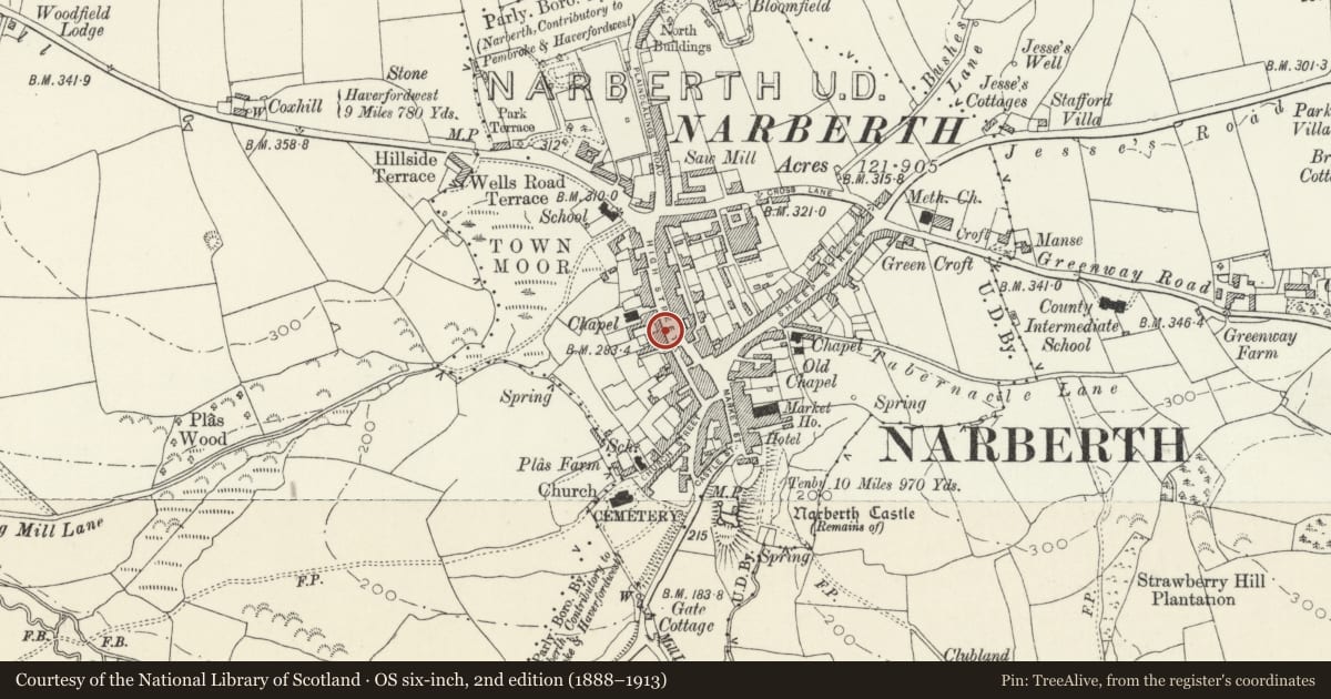
5 historical maps cover this location, the earliest the 1636 map "Cornubia : Devonia, Somersetus, Dorcestria, Wiltonia, Glocestria ..." (David Rumsey Map Collection, Stanford Libraries).
Historical maps covering this location
- 1636 · Cornubia : Devonia, Somersetus, Dorcestria, Wiltonia, Glocestria ... (David Rumsey Map Collection, Stanford Libraries)
- 1830 · V.3:11-15:XV. Britisches Reich. A. Kon: England. b. Frstenthum Wales: Shire: 37-40 (David Rumsey Map Collection, Stanford Libraries)
- 1891 · Sheet 10. Ordnance Survey of England and Wales. . (David Rumsey Map Collection, Stanford Libraries)
- 1898 · 228 Haverfordwest (Hills) (David Rumsey Map Collection, Stanford Libraries)
- 1901 · Sheet 13. (David Rumsey Map Collection, Stanford Libraries)
Cadw's description
Location
On the street line set back behind a narrow railed forecourt. Stepped down from No 33 adjoining.
Exterior
Early-mid C19. 2 storey 3 window building. Colourwashed plaster on rubble. Moderately pitched new slate roof, plain close eaves. No stacks. Victorian sash windows to 1st floor. Plain architraves, slate sills. 3 window bank front to ground floor left, channelled pilasters with moulded capitals, plain entablature, moulded cornice. Plate glass windows; doorway with plain rectangular fanlight to extreme left.
Modern carriage entry to extreme right.
Good geometric iron railings on stone base to forecourt with contemporary gatepiers and gate.
Reason for designation
Included for group value with other listed items at the S end of the High Street.
Nearby in the register
- Howell Williams Solicitor, County of Pembroke Sherriff's OfficeCommercialunder 1 mi
- PencraigDomesticunder 1 mi
- The Golden SheafCommercialunder 1 mi
- Town HallCivilunder 1 mi
Other entries of the same register within about three miles of this one, by straight line.