Cof Cymru: National Historic Assets of Wales · Wales
47 Prospect Place
Pembroke Dock, Pembrokeshire, Wales
A Grade II listed building in Pembroke Dock, Pembrokeshire, designated on 14 July 1981.
The record
- Designation
- Listed building, Grade II
- Broad class
- Domestic
- Date of designation
- 14 July 1981
- Community
- Pembroke Dock
- Unitary authority
- Pembrokeshire
- Country
- Wales
- Coordinates
- 51.68954, -4.94112
- Cadw reference
- 6451
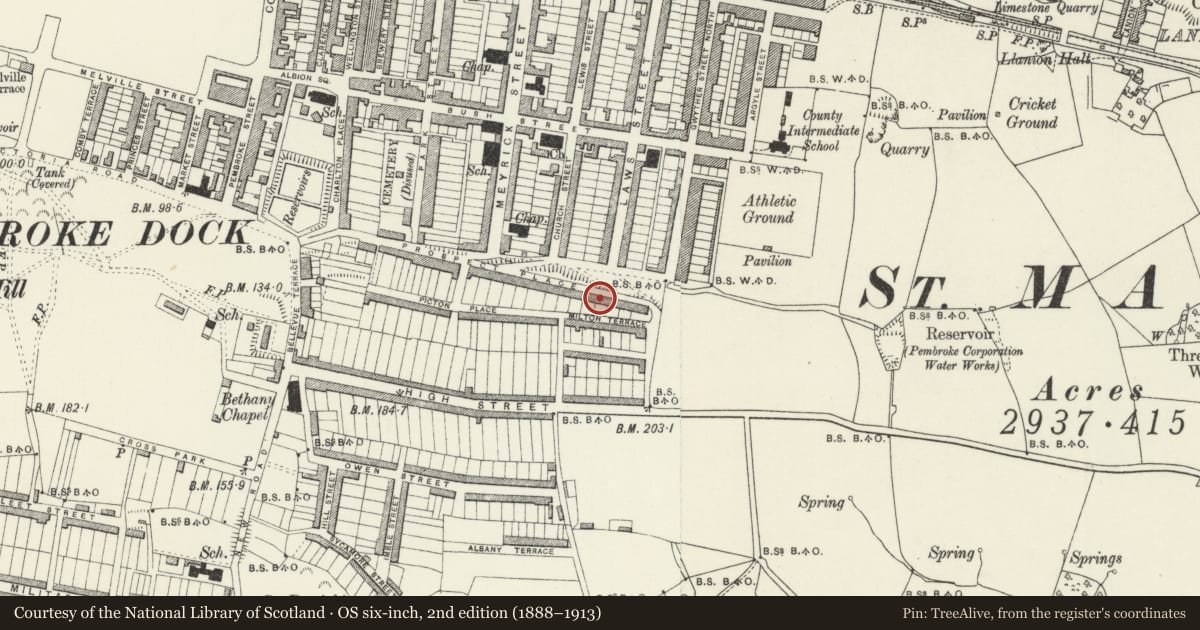
Slide toward Today to fade the historical sheet and see the modern map underneath.
David Rumsey Map Collection, Stanford LibrariesDavid Rumsey Map Collection, Stanford LibrariesDavid Rumsey Map Collection, Stanford LibrariesDavid Rumsey Map Collection, Stanford LibrariesDavid Rumsey Map Collection, Stanford Libraries
5 historical maps cover this location, the earliest the 1636 map "Cornubia : Devonia, Somersetus, Dorcestria, Wiltonia, Glocestria ..." (David Rumsey Map Collection, Stanford Libraries).
Historical maps covering this location
- 1636 · Cornubia : Devonia, Somersetus, Dorcestria, Wiltonia, Glocestria ... (David Rumsey Map Collection, Stanford Libraries)
- 1830 · V.3:11-15:XV. Britisches Reich. A. Kon: England. b. Frstenthum Wales: Shire: 37-40 (David Rumsey Map Collection, Stanford Libraries)
- 1865 · England and Wales. England No. 6. (David Rumsey Map Collection, Stanford Libraries)
- 1891 · Sheet 10. Ordnance Survey of England and Wales. . (David Rumsey Map Collection, Stanford Libraries)
- 1901 · Sheet 13. (David Rumsey Map Collection, Stanford Libraries)
Cadw's description
Location
Situated towards E end of stepped terraced row overlooking the town.
Exterior
Circa 1850 terraced house stepped uphill from No 46, painted stucco with imitation slate roof and rendered W end stack. Two-storey three-window front of renewed 16-pane horned sashes and centre arched doorway with 4-panel door and radiating tracery fanlight. In 1981 house had rusticated first floor and voussoirs to central doorway.
Reason for designation
Prominently sited in view from Laws Street. Not marked on 1848 Meyrick estate map but built shortly afterwards.
Nearby in the register
- 50 Prospect PlaceDomesticunder 1 mi
- 43 Prospect PlaceDomesticunder 1 mi
- 51 Prospect PlaceDomesticunder 1 mi
- 42 Prospect PlaceDomesticunder 1 mi
Other entries of the same register within about three miles of this one, by straight line.