Cof Cymru: National Historic Assets of Wales · Wales
5 South Parade
Tenby, Pembrokeshire, Wales
A Grade II listed building in Tenby, Pembrokeshire, designated on 26 April 1977.
The record
- Designation
- Listed building, Grade II
- Broad class
- Domestic
- Date of designation
- 26 April 1977
- Town
- Tenby
- Community
- Tenby
- Unitary authority
- Pembrokeshire
- Country
- Wales
- Coordinates
- 51.67208, -4.70183
- Cadw reference
- 6285
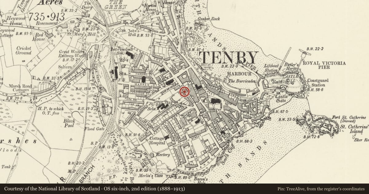
Slide toward Today to fade the historical sheet and see the modern map underneath.
David Rumsey Map Collection, Stanford LibrariesDavid Rumsey Map Collection, Stanford LibrariesDavid Rumsey Map Collection, Stanford LibrariesDavid Rumsey Map Collection, Stanford LibrariesDavid Rumsey Map Collection, Stanford Libraries
5 historical maps cover this location, the earliest the 1636 map "Cornubia : Devonia, Somersetus, Dorcestria, Wiltonia, Glocestria ..." (David Rumsey Map Collection, Stanford Libraries).
Historical maps covering this location
- 1636 · Cornubia : Devonia, Somersetus, Dorcestria, Wiltonia, Glocestria ... (David Rumsey Map Collection, Stanford Libraries)
- 1865 · England and Wales. England No. 6. (David Rumsey Map Collection, Stanford Libraries)
- 1891 · Sheet 10. Ordnance Survey of England and Wales. . (David Rumsey Map Collection, Stanford Libraries)
- 1898 · 245 Pembroke (Hills) (David Rumsey Map Collection, Stanford Libraries)
- 1901 · Sheet 13. (David Rumsey Map Collection, Stanford Libraries)
Cadw's description
Location
On the SW side of South Parade next to the fire station.
History
C19 end-terrace house, the larger one of the group of three including No 2 to left and No 3 beyond. The group is oddly numbered 3,2,5 in sequence from left.
Exterior
End-terrace house, painted stucco with slate close-eaved roof and red brick end stacks. 2-storey with slightly higher eaves than Nos 3 and 2, and double-fronted with 2 hornless 12-pane sashes each floor and centre arched doorway. Raised plinth. Plain fanlight over 4-panelled door. Gutter carried on small paired brackets. Right end wall is of stone rubble, rear is slate-hung.
Reason for designation
Included as a terraced house in late Georgian style with small-paned sashes, one of a group of three.
Nearby in the register
- GlyndwrDomesticunder 1 mi
- NythDomesticunder 1 mi
- Brychan YardDomesticunder 1 mi
- Cobbled pavement in Brychan YardDomesticunder 1 mi
Other entries of the same register within about three miles of this one, by straight line.