Cof Cymru: National Historic Assets of Wales · Wales
Premises occupied by Old Oak Insurance Brokers
Tenby, Pembrokeshire, Wales
A Grade II listed building in Tenby, Pembrokeshire, designated on 3 March 1961.
The record
- Designation
- Listed building, Grade II
- Broad class
- Commercial
- Date of designation
- 3 March 1961
- Town
- Tenby
- Community
- Tenby
- Unitary authority
- Pembrokeshire
- Country
- Wales
- Coordinates
- 51.67136, -4.70112
- Cadw reference
- 6283
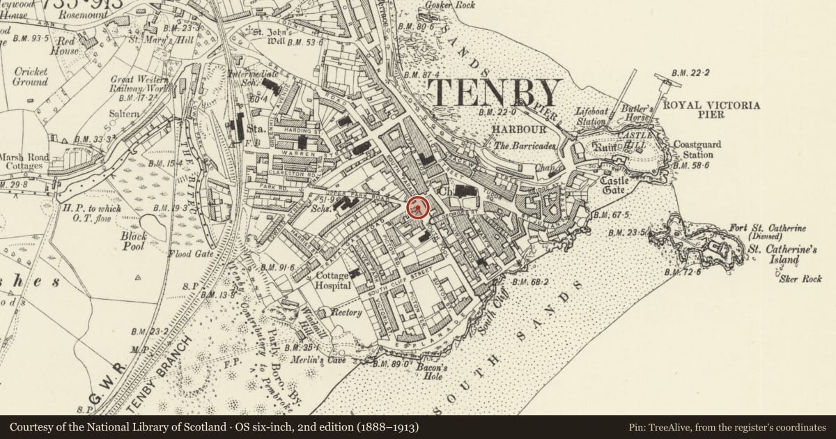
Slide toward Today to fade the historical sheet and see the modern map underneath.
David Rumsey Map Collection, Stanford LibrariesDavid Rumsey Map Collection, Stanford LibrariesDavid Rumsey Map Collection, Stanford LibrariesDavid Rumsey Map Collection, Stanford LibrariesDavid Rumsey Map Collection, Stanford Libraries
5 historical maps cover this location, the earliest the 1636 map "Cornubia : Devonia, Somersetus, Dorcestria, Wiltonia, Glocestria ..." (David Rumsey Map Collection, Stanford Libraries).
Historical maps covering this location
- 1636 · Cornubia : Devonia, Somersetus, Dorcestria, Wiltonia, Glocestria ... (David Rumsey Map Collection, Stanford Libraries)
- 1865 · England and Wales. England No. 6. (David Rumsey Map Collection, Stanford Libraries)
- 1891 · Sheet 10. Ordnance Survey of England and Wales. . (David Rumsey Map Collection, Stanford Libraries)
- 1898 · 245 Pembroke (Hills) (David Rumsey Map Collection, Stanford Libraries)
- 1901 · Sheet 13. (David Rumsey Map Collection, Stanford Libraries)
Cadw's description
Location
On the S side of the junction of South Parade, Upper Park Road and Trafalgar Road.
History
Commercial premises of c1900 incorporating at the rear 2 very substantial C16 rubble stone round chimneys, indicating the remains of a very large house outside the town walls.
Exterior
Commercial building, stucco with slate close-eaved roofs. Two storeys, 2 bays with first floor canted oriel to left, with 2-4-2-pane sashes and moulded cornice and 4-pane sash to right. Ground floor shopfront with timber flanking pilasters and fascia with cornice. Door with overlight recessed to left, double plate glass shop-window to right with smaller window canted in to door. Rendered side wall. Rear wall has two massive Pembrokeshire round chimneys set close to each other. Broader shorter round stack with rendered battered chimneybreast to right and taller narrower chimney to left, both with rings of thin stones below caps.
Reason for designation
Included for the two round C16 chimneys.
Nearby in the register
- The War MemorialReligious, Ritual and Funeraryunder 1 mi
- Tenby Town WallsDefenceunder 1 mi
- The Old Convent of St TeresaReligious, Ritual and Funeraryunder 1 mi
- 8 Upper Frog StreetCommercialunder 1 mi
Other entries of the same register within about three miles of this one, by straight line.