Cof Cymru: National Historic Assets of Wales · Wales
Garden wall to Quaintways
Tenby, Pembrokeshire, Wales
A Grade II listed building in Tenby, Pembrokeshire, designated on 26 April 1977.
The record
- Designation
- Listed building, Grade II
- Broad class
- Domestic
- Date of designation
- 26 April 1977
- Town
- Tenby
- Community
- Tenby
- Unitary authority
- Pembrokeshire
- Country
- Wales
- Coordinates
- 51.66995, -4.69929
- Cadw reference
- 6193
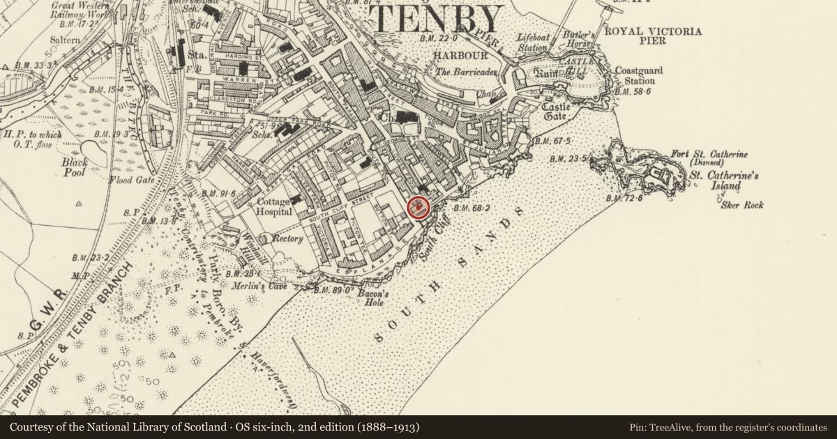
Slide toward Today to fade the historical sheet and see the modern map underneath.
David Rumsey Map Collection, Stanford LibrariesDavid Rumsey Map Collection, Stanford LibrariesDavid Rumsey Map Collection, Stanford LibrariesDavid Rumsey Map Collection, Stanford LibrariesDavid Rumsey Map Collection, Stanford Libraries
5 historical maps cover this location, the earliest the 1636 map "Cornubia : Devonia, Somersetus, Dorcestria, Wiltonia, Glocestria ..." (David Rumsey Map Collection, Stanford Libraries).
Historical maps covering this location
- 1636 · Cornubia : Devonia, Somersetus, Dorcestria, Wiltonia, Glocestria ... (David Rumsey Map Collection, Stanford Libraries)
- 1865 · England and Wales. England No. 6. (David Rumsey Map Collection, Stanford Libraries)
- 1891 · Sheet 10. Ordnance Survey of England and Wales. . (David Rumsey Map Collection, Stanford Libraries)
- 1898 · 245 Pembroke (Hills) (David Rumsey Map Collection, Stanford Libraries)
- 1901 · Sheet 13. (David Rumsey Map Collection, Stanford Libraries)
Cadw's description
Location
Along the Paragon from the town wall to Lower Frog Street opposite the Imperial Hotel.
History
Decorative garden wall, presumably earlier C19 and built for Belmont Houses, now the Imperial Hotel, across The Paragon, whose garden became the roadway for The Paragon in the C19. The houses were built in the 1830s. The Gothic niches appear purely decorative, though they could have been for bee-skeps. There is a wall marked here on the 1849 map.
Exterior
Garden wall, now facing roadway of The Paragon, rubble with rendered plinth and decorative coping of water-eroded rocks. Tooled limestone quoins at right end, left end abuts rear of town wall. Recessed within the wall to the right of centre, in that part of the wall against the left side of Quaintways, are a series of pointed niches with red brick heads and flush sills, seven in all, with a taller one in the centre. The jambs and heads are splayed inwards but openings were never pierced right through.
Reason for designation
Included as a decorative garden wall with Gothic niches, now part of the street character of The Paragon.
Nearby in the register
- No 4 Frogmore TerraceDomesticunder 1 mi
- No 3 Frogmore TerraceDomesticunder 1 mi
- Imperial HotelCommercialunder 1 mi
- No 2 Frogmore TerraceDomesticunder 1 mi
Other entries of the same register within about three miles of this one, by straight line.