Cof Cymru: National Historic Assets of Wales · Wales
No 2 Frogmore Terrace
Tenby, Pembrokeshire, Wales
A Grade II listed building in Tenby, Pembrokeshire, designated on 26 April 1977.
The record
- Designation
- Listed building, Grade II
- Broad class
- Domestic
- Date of designation
- 26 April 1977
- Town
- Tenby
- Community
- Tenby
- Unitary authority
- Pembrokeshire
- Country
- Wales
- Coordinates
- 51.67012, -4.69937
- Cadw reference
- 26305
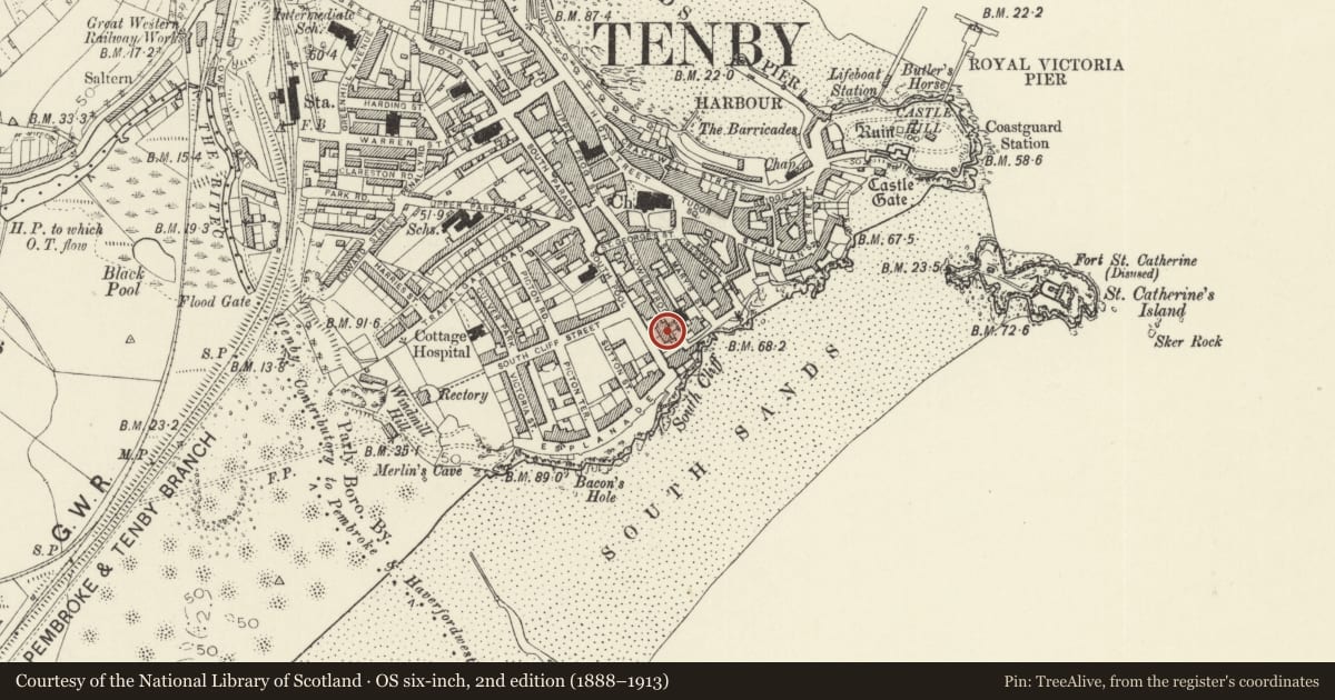
Slide toward Today to fade the historical sheet and see the modern map underneath.
David Rumsey Map Collection, Stanford LibrariesDavid Rumsey Map Collection, Stanford LibrariesDavid Rumsey Map Collection, Stanford LibrariesDavid Rumsey Map Collection, Stanford LibrariesDavid Rumsey Map Collection, Stanford Libraries
5 historical maps cover this location, the earliest the 1636 map "Cornubia : Devonia, Somersetus, Dorcestria, Wiltonia, Glocestria ..." (David Rumsey Map Collection, Stanford Libraries).
Historical maps covering this location
- 1636 · Cornubia : Devonia, Somersetus, Dorcestria, Wiltonia, Glocestria ... (David Rumsey Map Collection, Stanford Libraries)
- 1865 · England and Wales. England No. 6. (David Rumsey Map Collection, Stanford Libraries)
- 1891 · Sheet 10. Ordnance Survey of England and Wales. . (David Rumsey Map Collection, Stanford Libraries)
- 1898 · 245 Pembroke (Hills) (David Rumsey Map Collection, Stanford Libraries)
- 1901 · Sheet 13. (David Rumsey Map Collection, Stanford Libraries)
Cadw's description
Location
Set back from the street line on the SW side of Lower Frog Street near the junction with the Paragon.
History
The first house in a terrace of four three-storey town houses in late Georgian style, said to date from about 1840, and to be by Henry Rumley of Bristol. The scrolled rails to front doors also appear on Nos 8-14 Deer Park of c1870 and Nos 6-10 Croft Terrace c1845-65.
Exterior
Terraced house, the second in a row of 4, unpainted stucco with slate close eaved roof. One-window range of sashes to left and door to right. Basement and 3 storeys. Broad sill bands at first and second floors. Sash windows with original small-paned glazing, 9-pane to upper floor, arched to first and ground floors with radiating-bar heads, the ground floor window broader. Arched doorway up slate steps flanked by wrought iron railings of scroll design. Panelled doors of 2 long panels with horizontal panel above and below, and plain fanlight. Nos 1 and 4 have painted stucco surrounds.
Painted stucco basement with window to left, door under steps to front door.
Reason for designation
Included as part of one of a fine and little altered earlier C19 formal terrace.
Nearby in the register
- No 3 Frogmore TerraceDomesticunder 1 mi
- No 1 Frogmore TerraceDomesticunder 1 mi
- No 4 Frogmore TerraceDomesticunder 1 mi
- Railings to Frogmore TerraceGardens, Parks and Urban Spacesunder 1 mi
Other entries of the same register within about three miles of this one, by straight line.