Cof Cymru: National Historic Assets of Wales · Wales
Medieval structure in the churchyard
Tenby, Pembrokeshire, Wales
A Grade II* listed building in Tenby, Pembrokeshire, designated on 19 March 1951.
The record
- Designation
- Listed building, Grade II*
- Broad class
- Religious, Ritual and Funerary
- Date of designation
- 19 March 1951
- Town
- Tenby
- Community
- Tenby
- Unitary authority
- Pembrokeshire
- Country
- Wales
- Coordinates
- 51.67181, -4.70013
- Cadw reference
- 6175
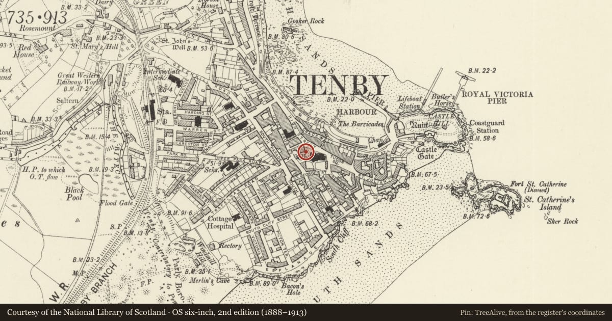
Slide toward Today to fade the historical sheet and see the modern map underneath.
David Rumsey Map Collection, Stanford LibrariesDavid Rumsey Map Collection, Stanford LibrariesDavid Rumsey Map Collection, Stanford LibrariesDavid Rumsey Map Collection, Stanford LibrariesDavid Rumsey Map Collection, Stanford Libraries
5 historical maps cover this location, the earliest the 1636 map "Cornubia : Devonia, Somersetus, Dorcestria, Wiltonia, Glocestria ..." (David Rumsey Map Collection, Stanford Libraries).
Historical maps covering this location
- 1636 · Cornubia : Devonia, Somersetus, Dorcestria, Wiltonia, Glocestria ... (David Rumsey Map Collection, Stanford Libraries)
- 1865 · England and Wales. England No. 6. (David Rumsey Map Collection, Stanford Libraries)
- 1891 · Sheet 10. Ordnance Survey of England and Wales. . (David Rumsey Map Collection, Stanford Libraries)
- 1898 · 245 Pembroke (Hills) (David Rumsey Map Collection, Stanford Libraries)
- 1901 · Sheet 13. (David Rumsey Map Collection, Stanford Libraries)
Cadw's description
Location
Situated some 20m W of the Church of Saint Mary in Liberty.
History
Ruins of a late medieval structure called the College, and described in the early C19 as the ruins of St Mary's College. The purpose is not in fact known but it may have been a choir school or used by chantry priests. The oddly flattened mouldings of the door are the same as those on the church W door which was dated 1496 and the S transept, also late C15. A drawing by Norris shows much more extensive remains in the early C19.
Exterior
East wall of demolished medieval building, some 10m long, 2.5 to 3m high. Rubble stone, with wide pointed arched doorway to left with hoodmould, like the W door of the church, but on a less bold scale. Bath stone. Series of some six or seven thin mouldings, hollow, hollow with rosettes, bead and ogee. Inscription in outer arch under hood. Wall is set back to right of door, then single flat-headed window with cusped pointed light. Smaller door to right with hoodmoulds and similar late C15 mouldings, more eroded and on a lesser splay. To right, a C15 fragment, cusped ogee head with 2 quatrefoils in spandrels. Reset stone below with eroded cross between rosettes. Traces of limewash on rear.
Reason for designation
Included as an important late medieval fragment, showing the unusual late Gothic seen in the Tenby church S porch and W door.
Nearby in the register
- Barclays BankCommercialunder 1 mi
- 17 High StreetCommercialunder 1 mi
- Churchyard gates, piers and railingsReligious, Ritual and Funeraryunder 1 mi
- 16 High StreetDomesticunder 1 mi
Other entries of the same register within about three miles of this one, by straight line.