Cof Cymru: National Historic Assets of Wales · Wales
Churchyard gates, piers and railings
Tenby, Pembrokeshire, Wales
A Grade II listed building in Tenby, Pembrokeshire, designated on 26 April 1977.
The record
- Designation
- Listed building, Grade II
- Broad class
- Religious, Ritual and Funerary
- Date of designation
- 26 April 1977
- Town
- Tenby
- Community
- Tenby
- Unitary authority
- Pembrokeshire
- Country
- Wales
- Coordinates
- 51.67199, -4.70010
- Cadw reference
- 6176
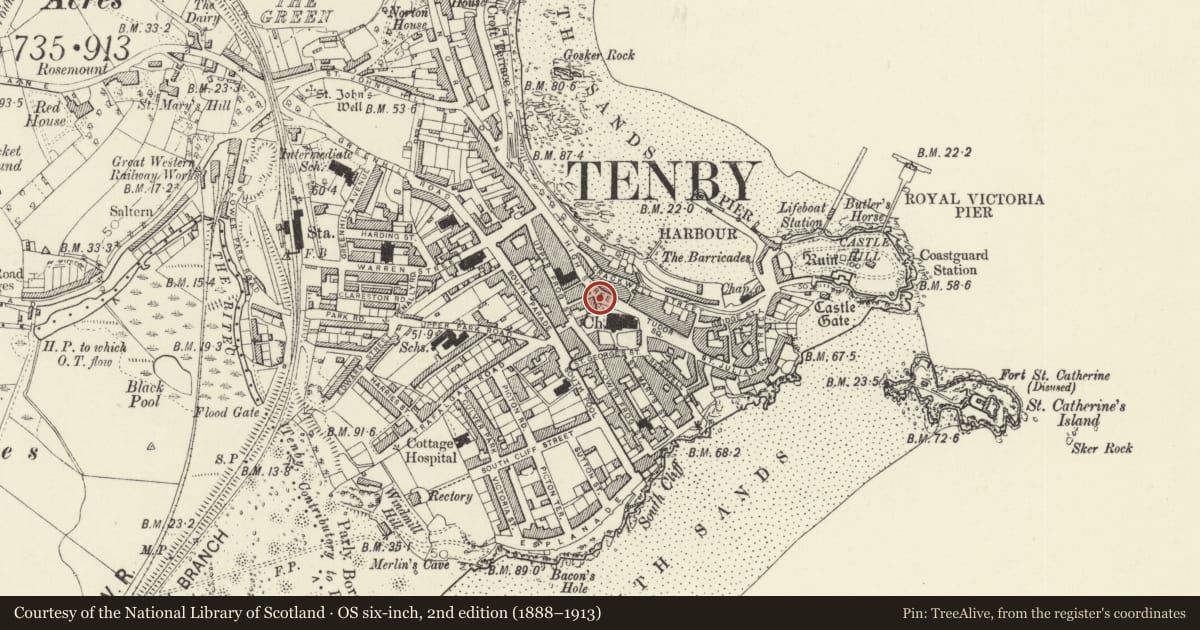
Slide toward Today to fade the historical sheet and see the modern map underneath.
David Rumsey Map Collection, Stanford LibrariesDavid Rumsey Map Collection, Stanford LibrariesDavid Rumsey Map Collection, Stanford LibrariesDavid Rumsey Map Collection, Stanford LibrariesDavid Rumsey Map Collection, Stanford Libraries
5 historical maps cover this location, the earliest the 1636 map "Cornubia : Devonia, Somersetus, Dorcestria, Wiltonia, Glocestria ..." (David Rumsey Map Collection, Stanford Libraries).
Historical maps covering this location
- 1636 · Cornubia : Devonia, Somersetus, Dorcestria, Wiltonia, Glocestria ... (David Rumsey Map Collection, Stanford Libraries)
- 1865 · England and Wales. England No. 6. (David Rumsey Map Collection, Stanford Libraries)
- 1891 · Sheet 10. Ordnance Survey of England and Wales. . (David Rumsey Map Collection, Stanford Libraries)
- 1898 · 245 Pembroke (Hills) (David Rumsey Map Collection, Stanford Libraries)
- 1901 · Sheet 13. (David Rumsey Map Collection, Stanford Libraries)
Cadw's description
Location
On the NE side of the churchyard of the Church of Saint Mary in Liberty.
History
Churchyard railings in High Victorian Gothic style, by David Brandon, part of his church restoration of 1865-9. The railings line the N side of the churchyard, to High St, with a slight return at NW to Bank House and a longer return along E end to Tudor Square, to finish against Tower House, Church Street.
Exterior
Low chamfered ashlar wall with ornate iron railings. Railings have big cinquefoils set within framework of rails and uprights. Rosettes in top rail and spear finials, and more ornate Gothic stanchions. Ashlar chamfered square gate piers at entrance to churchyard by Barclays Bank and at main N entrance to church. Main gate retains pair of fine cast-iron lamp standards, High Victorian Gothic, with ring-shafted short columns carrying turned pedestals for large lamps. Double gates with ironwork of a similar design to the railings. Church Street pedestrian gate is much smaller and has a single gatepier to right.
Reason for designation
Included as an example of High Victorian Gothic ironwork with well-designed stonework.
Nearby in the register
- Cellar under roadway, reached from Jasperley House.Domesticunder 1 mi
- 16 High StreetDomesticunder 1 mi
- 17 High StreetCommercialunder 1 mi
- Barclays BankCommercialunder 1 mi
Other entries of the same register within about three miles of this one, by straight line.