Cof Cymru: National Historic Assets of Wales · Wales
Wheelhouse
Tenby, Pembrokeshire, Wales
A Grade II listed building in Tenby, Pembrokeshire, designated on 3 March 1961.
The record
- Designation
- Listed building, Grade II
- Broad class
- Domestic
- Date of designation
- 3 March 1961
- Town
- Tenby
- Community
- Tenby
- Unitary authority
- Pembrokeshire
- Country
- Wales
- Coordinates
- 51.67163, -4.69769
- Cadw reference
- 6106
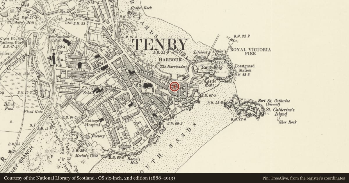
Slide toward Today to fade the historical sheet and see the modern map underneath.
David Rumsey Map Collection, Stanford LibrariesDavid Rumsey Map Collection, Stanford LibrariesDavid Rumsey Map Collection, Stanford LibrariesDavid Rumsey Map Collection, Stanford LibrariesDavid Rumsey Map Collection, Stanford Libraries
5 historical maps cover this location, the earliest the 1636 map "Cornubia : Devonia, Somersetus, Dorcestria, Wiltonia, Glocestria ..." (David Rumsey Map Collection, Stanford Libraries).
Historical maps covering this location
- 1636 · Cornubia : Devonia, Somersetus, Dorcestria, Wiltonia, Glocestria ... (David Rumsey Map Collection, Stanford Libraries)
- 1865 · England and Wales. England No. 6. (David Rumsey Map Collection, Stanford Libraries)
- 1891 · Sheet 10. Ordnance Survey of England and Wales. . (David Rumsey Map Collection, Stanford Libraries)
- 1898 · 245 Pembroke (Hills) (David Rumsey Map Collection, Stanford Libraries)
- 1901 · Sheet 13. (David Rumsey Map Collection, Stanford Libraries)
Cadw's description
Location
Situated on the S side of Bridge Street some 25m E of Quay Hill.
History
Earlier C19 three-storey terraced house, of which No 4 may have been a service range, but No 4 incorporates part of a medieval house. No 3 apparently rebuilt after 1834 view of Bridge St by Charles Norris.
Exterior
Terraced house, unpainted roughcast with slate close-eaved roof and short red brick left end stack. Plain three-storey double-fronted N facade with horned C20 plate glass sashes throughout, painted slate sills, and centre door. Two windows each floor, the upper ones half-length. Blank centre opening between upper windows. C20 half-glazed door to centre, boarded door to extreme right. In 1977 the main windows were sashes with glazing bars. Rear has narrow whitewashed external passage against bank behind with rear wing carried over on brick half-vault.
Interior
Not available for inspection but said to have narrow interior with centre stair rising from rear. Interior modernised. 1977 list mentions ground floor E room with small iron grate with round-arched opening, and 6-panel doors.
Reason for designation
Included as a late Georgian style house in one of the oldest streets of Tenby.
Nearby in the register
- 4 Bridge StreetDomesticunder 1 mi
- 2 Bridge StreetDomesticunder 1 mi
- Sparta HouseDomesticunder 1 mi
- Harbour CourtDomesticunder 1 mi
Other entries of the same register within about three miles of this one, by straight line.