Cof Cymru: National Historic Assets of Wales · Wales
4 Bridge Street
Tenby, Pembrokeshire, Wales
A Grade II listed building in Tenby, Pembrokeshire, designated on 3 March 1961.
The record
- Designation
- Listed building, Grade II
- Broad class
- Domestic
- Date of designation
- 3 March 1961
- Town
- Tenby
- Community
- Tenby
- Unitary authority
- Pembrokeshire
- Country
- Wales
- Coordinates
- 51.67164, -4.69761
- Cadw reference
- 26292
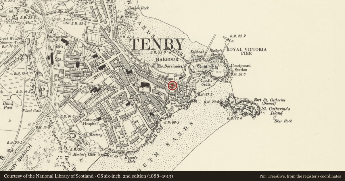
Slide toward Today to fade the historical sheet and see the modern map underneath.
David Rumsey Map Collection, Stanford LibrariesDavid Rumsey Map Collection, Stanford LibrariesDavid Rumsey Map Collection, Stanford LibrariesDavid Rumsey Map Collection, Stanford LibrariesDavid Rumsey Map Collection, Stanford Libraries
5 historical maps cover this location, the earliest the 1636 map "Cornubia : Devonia, Somersetus, Dorcestria, Wiltonia, Glocestria ..." (David Rumsey Map Collection, Stanford Libraries).
Historical maps covering this location
- 1636 · Cornubia : Devonia, Somersetus, Dorcestria, Wiltonia, Glocestria ... (David Rumsey Map Collection, Stanford Libraries)
- 1865 · England and Wales. England No. 6. (David Rumsey Map Collection, Stanford Libraries)
- 1891 · Sheet 10. Ordnance Survey of England and Wales. . (David Rumsey Map Collection, Stanford Libraries)
- 1898 · 245 Pembroke (Hills) (David Rumsey Map Collection, Stanford Libraries)
- 1901 · Sheet 13. (David Rumsey Map Collection, Stanford Libraries)
Cadw's description
Location
Situated on the S side of Bridge Street some 30m E of Quay Hill.
History
Early C19 house, perhaps once a service wing of No 3 adjoining, but incorporating much older masonry. A photograph in Tenby Museum shows a medieval door jamb and 3 stones of a pointed head, now rendered over, and there was a low timber bay window to right. A view by Norris of 1834 shows a ruin on the site of No 3 with round chimney and arched doorway to No 4.
Exterior
House, low unpainted roughcast two-storey facade with slate close-eaved roof. First floor 16-pane sash window (12-pane in 1977) to left over ground floor C20 boarded door with C20 tripartite sash window to right. In 1977 this was a single sash. Stone sill to first floor window, concrete sill to ground floor window. Raised plinth.
Interior
Not inspected.
Reason for designation
Included for group value with No 3, and as part of the terraced row on the S side of Bridge Street
Nearby in the register
- WheelhouseDomesticunder 1 mi
- Harbour CourtDomesticunder 1 mi
- Pier HouseDomesticunder 1 mi
- Sparta HouseDomesticunder 1 mi
Other entries of the same register within about three miles of this one, by straight line.