Cof Cymru: National Historic Assets of Wales · Wales
Stables and Loft at Llawhaden House
Llawhaden, Pembrokeshire, Wales
A Grade II listed building in Llawhaden Village, Llawhaden, Pembrokeshire, designated on 11 August 1997.
The record
- Designation
- Listed building, Grade II
- Broad class
- Domestic
- Date of designation
- 11 August 1997
- Locality
- Llawhaden Village
- Community
- Llawhaden
- Unitary authority
- Pembrokeshire
- Country
- Wales
- Coordinates
- 51.82178, -4.80160
- Cadw reference
- 18792
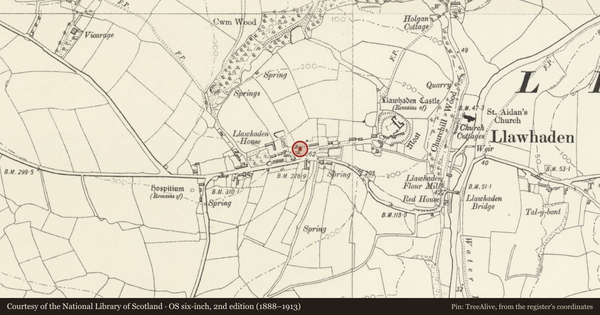
Slide toward Today to fade the historical sheet and see the modern map underneath.
David Rumsey Map Collection, Stanford LibrariesDavid Rumsey Map Collection, Stanford LibrariesDavid Rumsey Map Collection, Stanford LibrariesDavid Rumsey Map Collection, Stanford LibrariesDavid Rumsey Map Collection, Stanford Libraries
5 historical maps cover this location, the earliest the 1636 map "Cornubia : Devonia, Somersetus, Dorcestria, Wiltonia, Glocestria ..." (David Rumsey Map Collection, Stanford Libraries).
Historical maps covering this location
- 1636 · Cornubia : Devonia, Somersetus, Dorcestria, Wiltonia, Glocestria ... (David Rumsey Map Collection, Stanford Libraries)
- 1830 · V.3:11-15:XV. Britisches Reich. A. Kon: England. b. Frstenthum Wales: Shire: 37-40 (David Rumsey Map Collection, Stanford Libraries)
- 1891 · Sheet 10. Ordnance Survey of England and Wales. . (David Rumsey Map Collection, Stanford Libraries)
- 1898 · 228 Haverfordwest (Hills) (David Rumsey Map Collection, Stanford Libraries)
- 1901 · Sheet 13. (David Rumsey Map Collection, Stanford Libraries)
Cadw's description
Location
At the E side of the stable yard which lies N of Llawhaden House, beside the side entrance from the village street.
History
A mid-C19 stable building: not present on the Tithe map of 1839, but shown on the Ordnance Survey plan of 1888.
Exterior
A small stable range of the simplest architectural character, aligned N/S, facing W to the yard. Rubble masonry, with render on the S gable and old render remaining on most of the the W face. Slate roof. Access to the loft is by an external staircase and a door in a semi-dormer. One twelve-pane sash window in the W face, boarded doors, and ventilation tubes in the wall beneath the loft floor.
Interior
The loft floor is constructed of semi-converted timber beams. The roof is of seven bays, with common collar-beam trusses.
Reason for designation
Listed for Group Value with Llawhaden House and as part of a complete mid-C19 farmstead.
Nearby in the register
- Gatepiers and gates at Llawhaden HouseDomesticunder 1 mi
- Granary and Waggon House at Llawhaden HouseAgriculture and Subsistenceunder 1 mi
- Llawhaden HouseDomesticunder 1 mi
- Dovecote at Llawhaden HouseAgriculture and Subsistenceunder 1 mi
Other entries of the same register within about three miles of this one, by straight line.