Cof Cymru: National Historic Assets of Wales · Wales
Rowston Farmhouse
Stackpole and Castlemartin, Pembrokeshire, Wales
A Grade II listed building in Stackpole Elidor, Stackpole and Castlemartin, Pembrokeshire, designated on 14 May 1970.
The record
- Designation
- Listed building, Grade II
- Broad class
- Domestic
- Date of designation
- 14 May 1970
- Locality
- Stackpole Elidor
- Community
- Stackpole and Castlemartin
- Unitary authority
- Pembrokeshire
- Country
- Wales
- Coordinates
- 51.63837, -4.90316
- Cadw reference
- 6026
Slide toward Today to fade the historical sheet and see the modern map underneath.
David Rumsey Map Collection, Stanford LibrariesDavid Rumsey Map Collection, Stanford LibrariesDavid Rumsey Map Collection, Stanford LibrariesDavid Rumsey Map Collection, Stanford LibrariesDavid Rumsey Map Collection, Stanford Libraries
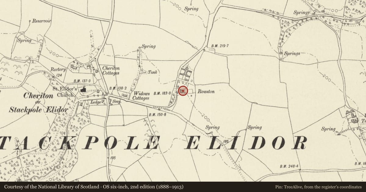
5 historical maps cover this location, the earliest the 1636 map "Cornubia : Devonia, Somersetus, Dorcestria, Wiltonia, Glocestria ..." (David Rumsey Map Collection, Stanford Libraries).
Historical maps covering this location
- 1636 · Cornubia : Devonia, Somersetus, Dorcestria, Wiltonia, Glocestria ... (David Rumsey Map Collection, Stanford Libraries)
- 1865 · England and Wales. England No. 6. (David Rumsey Map Collection, Stanford Libraries)
- 1891 · Sheet 10. Ordnance Survey of England and Wales. . (David Rumsey Map Collection, Stanford Libraries)
- 1898 · 245 Pembroke (Hills) (David Rumsey Map Collection, Stanford Libraries)
- 1901 · Sheet 13. (David Rumsey Map Collection, Stanford Libraries)
Cadw's description
Exterior
500 m E of Stackpole Elidyr church.
C 18 house facing N towards farmyard, two storeys plus cellars in a semi-basement. Originally there was a large W end-chimney of which only the wall and an oven remains. This oven is in an extremely large semi-circular extension, rendered and given a gabled and slated roof. The kitchen from which this was used has been demolished.
An early rear wing extends S and shows a gable on the S elevation. The angle between this wing and the main range was then filled in the Cl9 to complete a double-pile house, possibly in the late 1 860s when the adjacent farm buildings were built.
Rough-cast render overall. In the N elevation are C18 sash windows to the ground storey, with eight pane casements above. Above the door is a C20 reconstruction of an C18 sash window. Louvred openings to the dairy in the semi-basement.
Listed for group value with Rowston Farmyard.
Nearby in the register
- Old Bread Oven attached to Rowston FarmhouseCommercialunder 1 mi
- Rowston FarmyardAgriculture and Subsistenceunder 1 mi
- St. Elidyr's Church CrossReligious, Ritual and Funeraryunder 1 mi
- St. Elidyr's ChurchReligious, Ritual and Funeraryunder 1 mi
Other entries of the same register within about three miles of this one, by straight line.