Cof Cymru: National Historic Assets of Wales · Wales
Old Chimney in garden of No. 25
Lamphey, Pembrokeshire, Wales
A Grade II listed building in Lamphey Village, Lamphey, Pembrokeshire, designated on 14 May 1970.
The record
- Designation
- Listed building, Grade II
- Broad class
- Domestic
- Date of designation
- 14 May 1970
- Locality
- Lamphey Village
- Community
- Lamphey
- Unitary authority
- Pembrokeshire
- Country
- Wales
- Coordinates
- 51.66912, -4.86881
- Cadw reference
- 5969
Slide toward Today to fade the historical sheet and see the modern map underneath.
David Rumsey Map Collection, Stanford LibrariesDavid Rumsey Map Collection, Stanford LibrariesDavid Rumsey Map Collection, Stanford LibrariesDavid Rumsey Map Collection, Stanford LibrariesDavid Rumsey Map Collection, Stanford Libraries
5 historical maps cover this location, the earliest the 1636 map "Cornubia : Devonia, Somersetus, Dorcestria, Wiltonia, Glocestria ..." (David Rumsey Map Collection, Stanford Libraries).
Historical maps covering this location
- 1636 · Cornubia : Devonia, Somersetus, Dorcestria, Wiltonia, Glocestria ... (David Rumsey Map Collection, Stanford Libraries)
- 1865 · England and Wales. England No. 6. (David Rumsey Map Collection, Stanford Libraries)
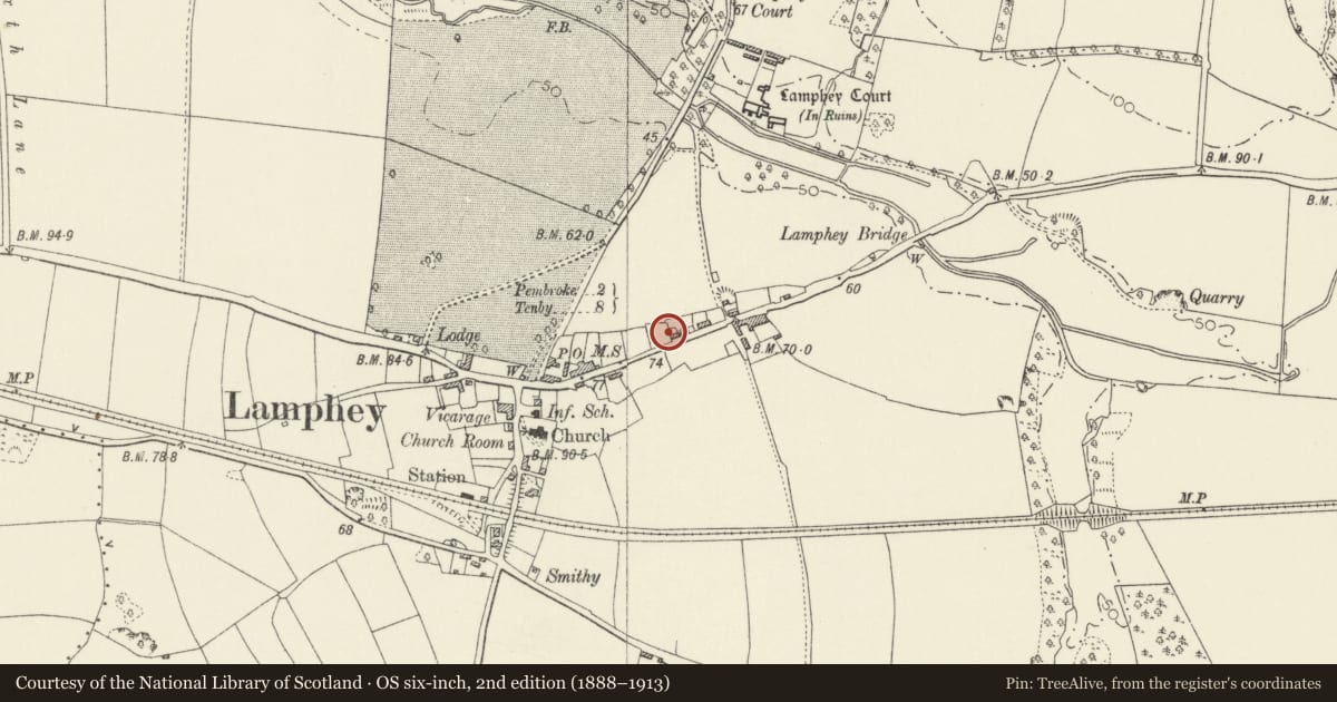
- 1891 · Sheet 10. Ordnance Survey of England and Wales. . (David Rumsey Map Collection, Stanford Libraries)
- 1898 · 245 Pembroke (Hills) (David Rumsey Map Collection, Stanford Libraries)
- 1901 · Sheet 13. (David Rumsey Map Collection, Stanford Libraries)
Cadw's description
Location
No. 25 is a modern house at the N side of The Ridgeway, at the NE of Lamphey village. The old round chimney stands detached in the garden E of the house.
Exterior
Cylindrical chimney on a tapering base with an oven and fireplace. Local rubble limestone. The cylindrical shaft is approx. 2.5 m high and 1 m diameter. Capping approx. 30 cm below the top and drip courses at the foot of the cylindrical shaft. Nothing remains above ground of the building it served. (It was possibly the lateral chimney on the W side of a cottage of C16/C17 appearance, with its gable to the street, of which an old illustration survives.)
Listed as a scarce serviving example of this regional type of chimney.
Nearby in the register
- Lamphey House (also known as the Old Malthouse)No class recordedunder 1 mi
- Farm Outbuildings to Rear Yard of Court HouseAgriculture and Subsistenceunder 1 mi
- Court HouseDomesticunder 1 mi
- Old School HouseEducationunder 1 mi
Other entries of the same register within about three miles of this one, by straight line.