Cof Cymru: National Historic Assets of Wales · Wales
Court House
Lamphey, Pembrokeshire, Wales
A Grade II listed building in Lamphey Village, Lamphey, Pembrokeshire, designated on 14 May 1970.
The record
- Designation
- Listed building, Grade II
- Broad class
- Domestic
- Date of designation
- 14 May 1970
- Locality
- Lamphey Village
- Community
- Lamphey
- Unitary authority
- Pembrokeshire
- Country
- Wales
- Coordinates
- 51.66857, -4.87113
- Cadw reference
- 5966
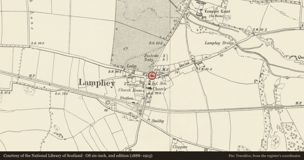
Slide toward Today to fade the historical sheet and see the modern map underneath.
David Rumsey Map Collection, Stanford LibrariesDavid Rumsey Map Collection, Stanford LibrariesDavid Rumsey Map Collection, Stanford LibrariesDavid Rumsey Map Collection, Stanford LibrariesDavid Rumsey Map Collection, Stanford Libraries
5 historical maps cover this location, the earliest the 1636 map "Cornubia : Devonia, Somersetus, Dorcestria, Wiltonia, Glocestria ..." (David Rumsey Map Collection, Stanford Libraries).
Historical maps covering this location
- 1636 · Cornubia : Devonia, Somersetus, Dorcestria, Wiltonia, Glocestria ... (David Rumsey Map Collection, Stanford Libraries)
- 1865 · England and Wales. England No. 6. (David Rumsey Map Collection, Stanford Libraries)
- 1891 · Sheet 10. Ordnance Survey of England and Wales. . (David Rumsey Map Collection, Stanford Libraries)
- 1898 · 245 Pembroke (Hills) (David Rumsey Map Collection, Stanford Libraries)
- 1901 · Sheet 13. (David Rumsey Map Collection, Stanford Libraries)
Cadw's description
Location
At the N of Lamphey village, at the turning to the lane which leads to Lamphey Court.
Exterior
Three-unit house with cross-passage between the left and centre units, facing S. There is a small rear yard with farm buildings.
History: Reputed to date from c.1695. The name derives from the use of the house as a court, the left (parlour) unit having been the courtroom. Subsequently the house has been a farmhouse.
Exterior: Rubble masonry, rendered and whitened. The house is of two storeys with a roof-covering of small slates and a chimney to each unit. The end chimneys have their flues in the wall thickness. Chimney stacks above roof level are brick, C19. Fenestration: range of four windows, with four-pane C19/C20 sashes and slate sills. Oven projection to right. Six-panel front door with a hood on shaped brackets. Full width extension at rear, basically original, with oven. Low wall at front with wrought-iron railings set into the coping and wrought-iron struts and gate. Arrow-head spikes to the railings.
Interior: The cross-passage from the front door leads to the stairs, which rise within the rear extension. The right unit (the old kitchen) has a large fireplace projecting externally at E and a large bread oven, the front of which is missing. Cellar below the left unit.
Farm Buildings: Small rear farmyard, with at N a cowshed with heck door. Blocked low arch in its S wall facing the yard. At E a larger cowshed with a granary above, and with stairs to the granary at its S end. Boarded doors with timber lintels. At S, attached to the house, a small stable and a shed. All in rubble masonry with slate (or sheeted) roofs.
Listed as a house of regional character with old farm buildings around its rear yard and a wall with iron railings to front, and additionally for group value with the Church.
Nearby in the register
- Farm Outbuildings to Rear Yard of Court HouseAgriculture and Subsistenceunder 1 mi
- Upright Grave Slab in Old School House Wall (Formerly included with Lamphey Church)Religious, Ritual and Funeraryunder 1 mi
- Old School HouseEducationunder 1 mi
- Church of St Tyfie and St FaithReligious, Ritual and Funeraryunder 1 mi
Other entries of the same register within about three miles of this one, by straight line.