Cof Cymru: National Historic Assets of Wales · Wales
Upright Grave Slab in Old School House Wall (Formerly included with Lamphey Church)
Lamphey, Pembrokeshire, Wales
A Grade II listed building in Lamphey Village, Lamphey, Pembrokeshire, designated on 14 May 1970.
The record
- Designation
- Listed building, Grade II
- Broad class
- Religious, Ritual and Funerary
- Date of designation
- 14 May 1970
- Locality
- Lamphey Village
- Community
- Lamphey
- Unitary authority
- Pembrokeshire
- Country
- Wales
- Coordinates
- 51.66827, -4.87162
- Cadw reference
- 5964
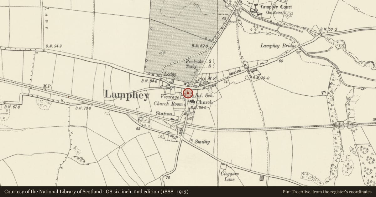
Slide toward Today to fade the historical sheet and see the modern map underneath.
David Rumsey Map Collection, Stanford LibrariesDavid Rumsey Map Collection, Stanford LibrariesDavid Rumsey Map Collection, Stanford LibrariesDavid Rumsey Map Collection, Stanford LibrariesDavid Rumsey Map Collection, Stanford Libraries
5 historical maps cover this location, the earliest the 1636 map "Cornubia : Devonia, Somersetus, Dorcestria, Wiltonia, Glocestria ..." (David Rumsey Map Collection, Stanford Libraries).
Historical maps covering this location
- 1636 · Cornubia : Devonia, Somersetus, Dorcestria, Wiltonia, Glocestria ... (David Rumsey Map Collection, Stanford Libraries)
- 1865 · England and Wales. England No. 6. (David Rumsey Map Collection, Stanford Libraries)
- 1891 · Sheet 10. Ordnance Survey of England and Wales. . (David Rumsey Map Collection, Stanford Libraries)
- 1898 · 245 Pembroke (Hills) (David Rumsey Map Collection, Stanford Libraries)
- 1901 · Sheet 13. (David Rumsey Map Collection, Stanford Libraries)
Cadw's description
Location
20 m N of the lychgate of Lamphey Church.
Exterior
A mediaeval grave slab set upright into the garden wall of the Old School House. Possibly the slab was taken up when extensive improvements were carried out to the church in 1826 and removed here when the schoolmaster's house and its garden were formed shortly afterwards. It was in its present position when reported in the Inventory in 1925.
The slab consists of a single slab of limestone at least 1.8 m long (high), by 15 cm thick, and tapering from about 45 to 40 cm in width. On its front (now facing the road) is an incised cross in very shallow double lines, extending to all edges of the stone. Midway in each arm is a rounded shape. The sides and rear of the stone, so far as visible, are rough-hewn. No inscription has been seen.
Listed as a mediaeval carved stone.
Reference: RCAHM Inventory (1925) 134
Nearby in the register
- Old School HouseEducationunder 1 mi
- Church of St Tyfie and St FaithReligious, Ritual and Funeraryunder 1 mi
- Court HouseDomesticunder 1 mi
- Farm Outbuildings to Rear Yard of Court HouseAgriculture and Subsistenceunder 1 mi
Other entries of the same register within about three miles of this one, by straight line.