Cof Cymru: National Historic Assets of Wales · Wales
Carew Inn
Carew, Pembrokeshire, Wales
A Grade II listed building in Carew Village, Tenby, Carew, Pembrokeshire, designated on 14 May 1970.
The record
- Designation
- Listed building, Grade II
- Broad class
- Commercial
- Date of designation
- 14 May 1970
- Locality
- Carew Village
- Town
- Tenby
- Community
- Carew
- Unitary authority
- Pembrokeshire
- Country
- Wales
- Coordinates
- 51.69811, -4.82753
- Cadw reference
- 5942
Slide toward Today to fade the historical sheet and see the modern map underneath.
David Rumsey Map Collection, Stanford LibrariesDavid Rumsey Map Collection, Stanford LibrariesDavid Rumsey Map Collection, Stanford LibrariesDavid Rumsey Map Collection, Stanford LibrariesDavid Rumsey Map Collection, Stanford Libraries
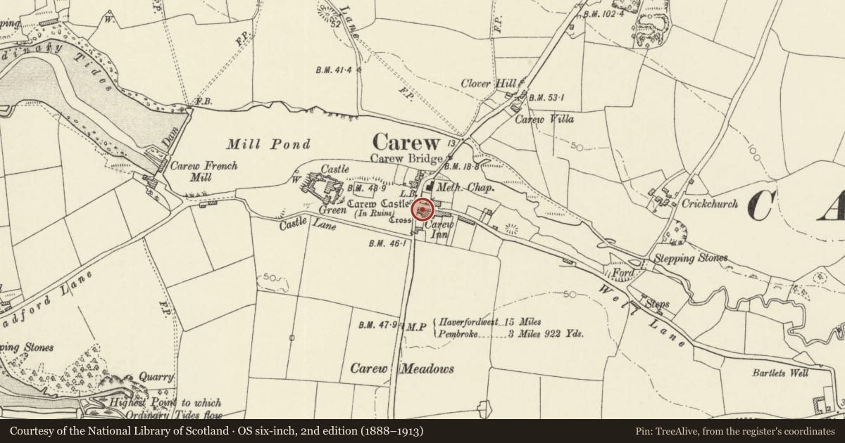
5 historical maps cover this location, the earliest the 1636 map "Cornubia : Devonia, Somersetus, Dorcestria, Wiltonia, Glocestria ..." (David Rumsey Map Collection, Stanford Libraries).
Historical maps covering this location
- 1636 · Cornubia : Devonia, Somersetus, Dorcestria, Wiltonia, Glocestria ... (David Rumsey Map Collection, Stanford Libraries)
- 1865 · England and Wales. England No. 6. (David Rumsey Map Collection, Stanford Libraries)
- 1891 · Sheet 10. Ordnance Survey of England and Wales. . (David Rumsey Map Collection, Stanford Libraries)
- 1898 · 228 Haverfordwest (Hills) (David Rumsey Map Collection, Stanford Libraries)
- 1901 · Sheet 13. (David Rumsey Map Collection, Stanford Libraries)
Cadw's description
Location
At the junction of the village main street and the A4075. At the front are cast-iron railings on a high plinth wall of rubble masonry.
History
Mid-C19. It is shown but not marked as an inn on the 1864 O S Map. On the 1907 Map it is shown with its W extension and named as the Carew Inn.
Exterior
A house with a rear service wing and a wing to the W side. Random rubble limestone masonry generally, informally coursed on the gable wall of the side extension. Slate roofs with brick end-chimneys to the main part, the rear wing and the side extension. The original house is of three storeys facing N. Three windows in width including a blank fenestration panel at first and second storey levels. Central door of four glazed lights and two flush panels. Canopy on brackets. The extension to the W is of two storeys with two windows above and one large window below. Apart from the last-mentioned, all are mid-C19 four-pane windows with horned sashes. All the windows and the blank panels have render surrounds.
Reason for designation
Listed for group value with the adjacent cottages.
Nearby in the register
- No 1 & 2Domesticunder 1 mi
- Carew CrossCrossunder 1 mi
- The Carew CrossReligious, Ritual and Funeraryunder 1 mi
- Castle Entrance Gatepiers and Old Cobbler's ShopDomesticunder 1 mi
Other entries of the same register within about three miles of this one, by straight line.