Cof Cymru: National Historic Assets of Wales · Wales
Benar Barn
Bro Machno, Conwy, Wales
A Grade II listed building in Benar, Bro Machno, Conwy, designated on 17 July 1992.
The record
- Designation
- Listed building, Grade II
- Broad class
- Agriculture and Subsistence
- Date of designation
- 17 July 1992
- Locality
- Benar
- Community
- Bro Machno
- Unitary authority
- Conwy
- Country
- Wales
- Coordinates
- 53.04970, -3.79990
- Cadw reference
- 5852
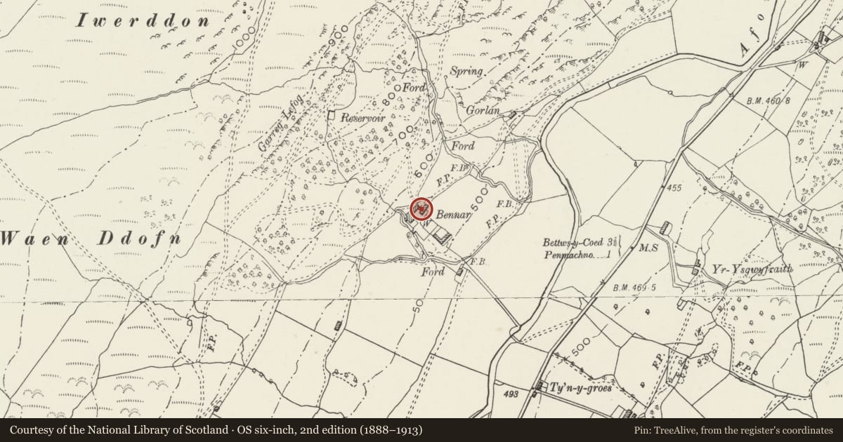
Slide toward Today to fade the historical sheet and see the modern map underneath.
David Rumsey Map Collection, Stanford LibrariesLlyfrgell Genedlaethol Cymru – The National Library of WalesDavid Rumsey Map Collection, Stanford LibrariesDavid Rumsey Map Collection, Stanford LibrariesDavid Rumsey Map Collection, Stanford Libraries
5 historical maps cover this location, the earliest the 1608 map "(13) Cambriae Typus." (David Rumsey Map Collection, Stanford Libraries).
Historical maps covering this location
- 1608 · (13) Cambriae Typus. (David Rumsey Map Collection, Stanford Libraries)
- 1795 · To Sir Watkin Williams-Wynn Bart ... the map of the six counties of North Wales is most… (Llyfrgell Genedlaethol Cymru – The National Library of Wales)
- 1830 · V.3:11-15:XV. Britisches Reich. A. Kon: England. b. Frstenthum Wales: Shire: 37-40 (David Rumsey Map Collection, Stanford Libraries)
- 1883 · Watershed map England, Wales 3. (David Rumsey Map Collection, Stanford Libraries)
- 1901 · Sheet 9 and 10. (David Rumsey Map Collection, Stanford Libraries)
Cadw's description
Location
Approx 20 metres E of house. Aligned roughly SW-NE, facing Afon Machno.
History
C17 barn probably former stables; formerly lofted. Extended and altered in C19.
Exterior
Coursed local flat rubble slabs to gable ends, random rubble to long sides. On plinth. Modern slate roof. Front elevation has camber-headed doorway with blue brick dressings. Camber-headed windows (C19 in current form) to ground floor, immediately above which are windows to former loft set at eaves. Blue brick dressings and small pane agricultural-type glazing to windows with vents below. Gable end facing house has loft doorway with simple stone lintel. Opposite gable end has loft doorway/window obscured by C19 extension. Building extended in line to NE (C19) as single storey outbuilding in local rubble with slate roof; square-headed doorway and, to R, square agricultural-type small-pane window.
Interior
Interior of barn has massive stop-chamfered hewn beams and was formerly completely lofted. A few stop-chamfered joists remain. Roof has much of old structure.
Reason for designation
Listed for group value with Benar Farmhouse.
Nearby in the register
- Benar Farmhouse, including Forecourt Wall and StairsDomesticunder 1 mi
- Privy at BenarDomesticunder 1 mi
- YsgwyfraithDomesticunder 1 mi
- Root Camp at Ty'n y Coed UchafGardens, Parks and Urban Spacesunder 1 mi
Other entries of the same register within about three miles of this one, by straight line.