Cof Cymru: National Historic Assets of Wales · Wales
3 Tros yr Afon
Beaumaris, Isle of Anglesey, Wales
A Grade II listed building in Beaumaris, Isle of Anglesey, designated on 23 September 1950.
The record
- Designation
- Listed building, Grade II
- Broad class
- Domestic
- Date of designation
- 23 September 1950
- Locality
- Beaumaris
- Town
- Beaumaris
- Community
- Beaumaris
- Unitary authority
- Isle of Anglesey
- Country
- Wales
- Coordinates
- 53.26100, -4.09892
- Cadw reference
- 5681
Slide toward Today to fade the historical sheet and see the modern map underneath.
David Rumsey Map Collection, Stanford LibrariesDavid Rumsey Map Collection, Stanford LibrariesDavid Rumsey Map Collection, Stanford LibrariesDavid Rumsey Map Collection, Stanford LibrariesDavid Rumsey Map Collection, Stanford Libraries
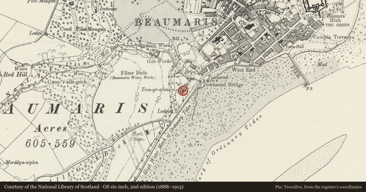
5 historical maps cover this location, the earliest the 1883 map "Watershed map England, Wales 3." (David Rumsey Map Collection, Stanford Libraries).
Historical maps covering this location
- 1883 · Watershed map England, Wales 3. (David Rumsey Map Collection, Stanford Libraries)
- 1896 · Sheet 7. Ordnance Survey of England and Wales. (David Rumsey Map Collection, Stanford Libraries)
- 1899 · 94 Beaumaris (Hills) (David Rumsey Map Collection, Stanford Libraries)
- 1901 · Sheet 9 and 10. (David Rumsey Map Collection, Stanford Libraries)
- 1919 · Sheet 41. Anglesey. (David Rumsey Map Collection, Stanford Libraries)
Cadw's description
Location
Set back from the road in a short terrace between Mill Lane and Cae Mair.
History
An early C19 house added to the earlier No 2 and shown on the 1829 town plan as part of a terrace of 4 houses.
Exterior
A late-Georgian 2-storey 3-bay house with pebble-dashed front, slate roof and shared roughcast end stacks. Openings are offset slightly to the R. A central fielded-panel door has a small-pane overlight, in a shallow, open wooden porch with latticework sides. In the L-hand bay are French doors. In the R-hand bay is a 12-pane hornless sash window. In the upper storey are 16-pane sashes in the outer bays, of which the R-hand is hornless, and 12-pane sash window in the centre.
The rear has gabled bays, slate-hung in the upper storey and with 12-pane hornless sash window to the upper storey of the L-hand.
Interior
Not inspected.
Reason for designation
Listed for its special architectural interest as a well-preserved early C19 town house, part of a short, well-preserved terrace that makes an important contribution to the historical integrity of Townsend.
Nearby in the register
- 4 Tros yr AfonDomesticunder 1 mi
- 2 Tros yr AfonDomesticunder 1 mi
- 1 Tros yr AfonDomesticunder 1 mi
- Outbuilding behind 4 Tros yr AfonNo class recordedunder 1 mi
Other entries of the same register within about three miles of this one, by straight line.