Cof Cymru: National Historic Assets of Wales · Wales
Outbuilding at entrance to the Orchard
Beaumaris, Isle of Anglesey, Wales
A Grade II listed building in Beaumaris, Isle of Anglesey, designated on 23 September 1950.
The record
- Designation
- Listed building, Grade II
- Broad class
- Domestic
- Date of designation
- 23 September 1950
- Locality
- Beaumaris
- Town
- Beaumaris
- Community
- Beaumaris
- Unitary authority
- Isle of Anglesey
- Country
- Wales
- Coordinates
- 53.26234, -4.09675
- Cadw reference
- 5660
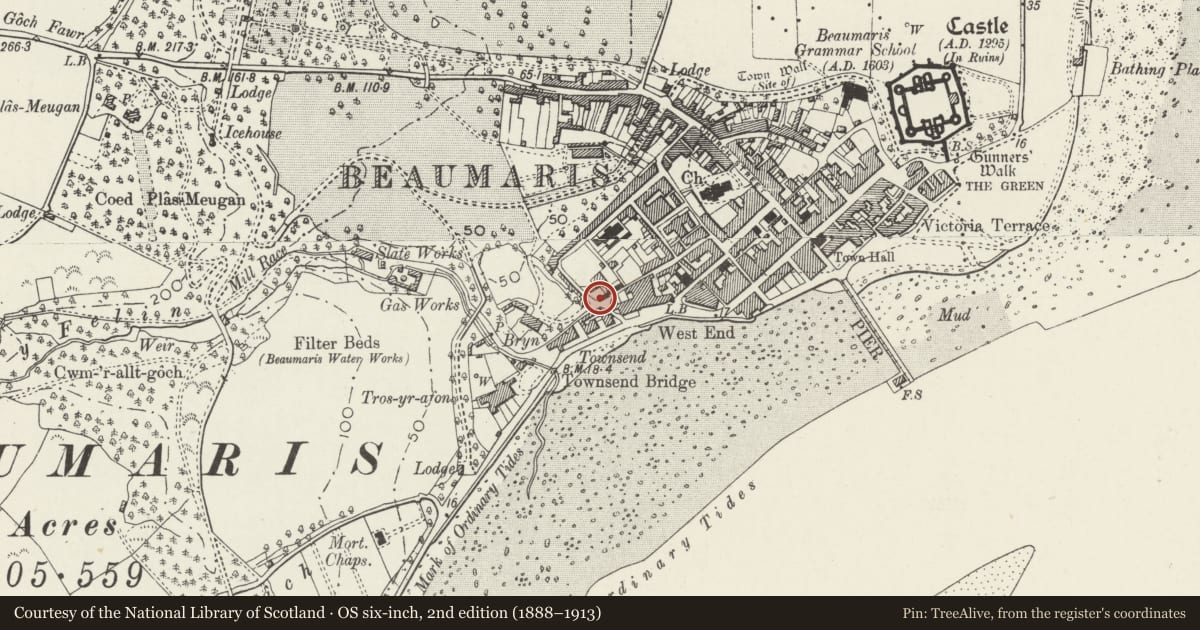
Slide toward Today to fade the historical sheet and see the modern map underneath.
David Rumsey Map Collection, Stanford LibrariesDavid Rumsey Map Collection, Stanford LibrariesDavid Rumsey Map Collection, Stanford LibrariesDavid Rumsey Map Collection, Stanford LibrariesDavid Rumsey Map Collection, Stanford Libraries
5 historical maps cover this location, the earliest the 1883 map "Watershed map England, Wales 3." (David Rumsey Map Collection, Stanford Libraries).
Historical maps covering this location
- 1883 · Watershed map England, Wales 3. (David Rumsey Map Collection, Stanford Libraries)
- 1896 · Sheet 7. Ordnance Survey of England and Wales. (David Rumsey Map Collection, Stanford Libraries)
- 1899 · 94 Beaumaris (Hills) (David Rumsey Map Collection, Stanford Libraries)
- 1901 · Sheet 9 and 10. (David Rumsey Map Collection, Stanford Libraries)
- 1919 · Sheet 41. Anglesey. (David Rumsey Map Collection, Stanford Libraries)
Cadw's description
Location
On the E side of the entrance to the Orchard on the corner with New Street.
History
An outbuilding shown on the 1829 town plan, later extended on the R side.
Exterior
Rubble-stone outbuilding under a monopitch slate roof, and with a loft on the L side. Facing the road the lofted section has former garage doors infilled with boarding and a single door. The loft has been rebuilt mainly in brick and has a replacement window. To the R is a flat projection, which has a boarded door with glazed panel, behind which is a monopitched roof. In the L side wall, behind the line of the former garden wall, is a loft doorway, part blocked and converted to a window.
The rear has added external steps with cement treads and pebble-dashed wall, to a boarded door cut through a blocked brick arch.
Reason for designation
Listed, notwithstanding alteration of windows, for its special interest as an integral part of a group of outbuildings associated with a large early C19 house now known as The Orchard, The Hermitage and Old Barracks Cottage, and for its contribution to the historical integrity of Rosemary Lane.
Nearby in the register
- Hermitage CottageDomesticunder 1 mi
- Doorway at entrance to The HermitageDomesticunder 1 mi
- The OrchardDomesticunder 1 mi
- Old Barracks CottageDomesticunder 1 mi
Other entries of the same register within about three miles of this one, by straight line.