Cof Cymru: National Historic Assets of Wales · Wales
Folly Tower at Talacre Abbey
Llanasa, Flintshire, Wales
A Grade II listed building in Talacre, Llanasa, Flintshire, designated on 2 April 1987.
The record
- Designation
- Listed building, Grade II
- Broad class
- Gardens, Parks and Urban Spaces
- Date of designation
- 2 April 1987
- Locality
- Talacre
- Community
- Llanasa
- Unitary authority
- Flintshire
- Country
- Wales
- Coordinates
- 53.33939, -3.34527
- Cadw reference
- 562
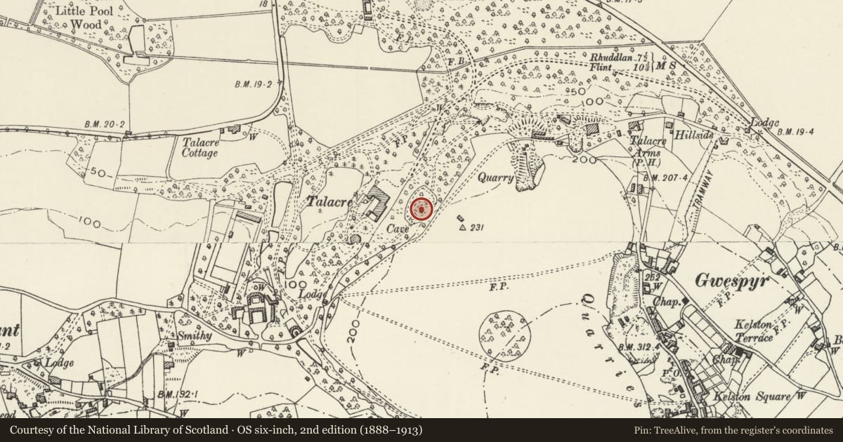
Slide toward Today to fade the historical sheet and see the modern map underneath.
David Rumsey Map Collection, Stanford LibrariesDavid Rumsey Map Collection, Stanford LibrariesDavid Rumsey Map Collection, Stanford LibrariesNational Library of ScotlandNational Library of Scotland
5 historical maps cover this location, the earliest the 1883 map "Watershed map England, Wales 3." (David Rumsey Map Collection, Stanford Libraries).
Historical maps covering this location
- 1883 · Watershed map England, Wales 3. (David Rumsey Map Collection, Stanford Libraries)
- 1885 · OS One-Inch (Hills) 1885-1903 (National Library of Scotland)
- 1896 · 96 Liverpool (Hills) (David Rumsey Map Collection, Stanford Libraries)
- 1901 · Sheet 9 and 10. (David Rumsey Map Collection, Stanford Libraries)
- 1930 · OS Popular Edition 1919-1947 (National Library of Scotland)
Cadw's description
Location
In woodland on the SE side of the house.
History
Talacre Abbey was built 1824-9 by Thomas Jones, architect, for Sir Edward Mostyn, on the site of an earlier house. The folly tower, built to provide views over the Dee Estuary to the N, was built in the third quarter of the C19 and is shown on the 1871 Ordnance Survey.
Exterior
A 2-stage tower of rubble-stone walls built partly on exposed bedrock, but in ruinous condition and obscured by vegetation. The main pointed doorway is in the N wall, while in the E wall is a doorway leading to stairs to the upper stage. On the W side is a shallow projection with a second lower-stage doorway, and an attached wall. The upper stage has large openings in the N and W walls, and a small opening in the E wall.
Interior
In the lower stage is a shell room, incorporating fireplace and bench, in which the walls are covered with shells and quartz. The projection on the W side incorporates side benches.
Reason for designation
Listed as an important component of the landscaped park at Talacre Abbey and as an important component of the pleasure grounds at Talacre Abbey.
Nearby in the register
- Grotto adjoining Folly Tower at Talacre AbbeyGardens, Parks and Urban Spacesunder 1 mi
- Talacre AbbeyReligious, Ritual and Funeraryunder 1 mi
- Walls enclosing service yard at Talacre Abbey, with steps to gardenGardens, Parks and Urban Spacesunder 1 mi
- Terrace on N side of Talacre AbbeyGardens, Parks and Urban Spacesunder 1 mi
Other entries of the same register within about three miles of this one, by straight line.