Cof Cymru: National Historic Assets of Wales · Wales
Ty'n Llan
Bodorgan, Isle of Anglesey, Wales
A Grade II listed building in Trefdraeth, Bodorgan, Isle of Anglesey, designated on 30 January 1968.
The record
- Designation
- Listed building, Grade II
- Broad class
- Domestic
- Date of designation
- 30 January 1968
- Locality
- Trefdraeth
- Community
- Bodorgan
- Unitary authority
- Isle of Anglesey
- Country
- Wales
- Coordinates
- 53.20635, -4.38414
- Cadw reference
- 5565
Slide toward Today to fade the historical sheet and see the modern map underneath.
David Rumsey Map Collection, Stanford LibrariesDavid Rumsey Map Collection, Stanford LibrariesDavid Rumsey Map Collection, Stanford LibrariesDavid Rumsey Map Collection, Stanford LibrariesDavid Rumsey Map Collection, Stanford Libraries
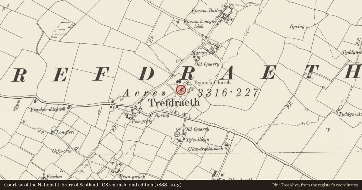
5 historical maps cover this location, the earliest the 1883 map "Watershed map England, Wales 3." (David Rumsey Map Collection, Stanford Libraries).
Historical maps covering this location
- 1883 · Watershed map England, Wales 3. (David Rumsey Map Collection, Stanford Libraries)
- 1896 · Sheet 7. Ordnance Survey of England and Wales. (David Rumsey Map Collection, Stanford Libraries)
- 1899 · 105 Carnarvon (Hills) (David Rumsey Map Collection, Stanford Libraries)
- 1901 · Sheet 9 and 10. (David Rumsey Map Collection, Stanford Libraries)
- 1919 · Sheet 41. Anglesey. (David Rumsey Map Collection, Stanford Libraries)
Cadw's description
Location
Located in the centre of the small hamlet of Trefdraeth; set back from the N side of the road leading E from Bethel. The cottage is reached by a private lane and lies c. 50m SSE of the church of St. Beuno.
History
C18 vernacular cottage; recorded on the Terrier of Trefdraeth parish, 1790. Used as a church house for the nearby Church of St. Beuno.
Exterior
Single storey, 2-window vernacular cottage, with former cowhouse to right (N), now with 3 windows. Built of rubble masonry on boulder foundations, rendered elevations. Modern slate roof; rendered gable stacks with dripstones and cappings. East front: 2 windows with doorway between, openings slightly offset to right (N), 2 windows to rear; wing to right (N) with 2-window rear elevation. Windows are slightly recessed, modern 4-pane centrally fixed lights.
Reason for designation
Included as a well-documented example of a C18 single storey cottage retaining vernacular character in layout retaining the distinction between house and former cow-house, and in the scale of its detail. It also forms a group with the church of Saint Beuno.
Nearby in the register
- Church of St. Beuno (Eglwys Beuno Sant)Religious, Ritual and Funeraryunder 1 mi
- Glantraeth HouseDomesticunder 1 mi
- Gate piers to south of TrefeilirDomesticunder 1 mi
- Gate piers and walls to east of TrefeilirDomesticunder 1 mi
Other entries of the same register within about three miles of this one, by straight line.