Cof Cymru: National Historic Assets of Wales · Wales
Garth Tower
Cwm Cadnant, Isle of Anglesey, Wales
A Grade II listed building in Glyn Garth, Cwm Cadnant, Isle of Anglesey, designated on 30 January 1968.
The record
- Designation
- Listed building, Grade II
- Broad class
- Domestic
- Date of designation
- 30 January 1968
- Locality
- Glyn Garth
- Community
- Cwm Cadnant
- Unitary authority
- Isle of Anglesey
- Country
- Wales
- Coordinates
- 53.24544, -4.12903
- Cadw reference
- 5478
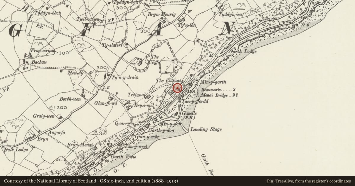
Slide toward Today to fade the historical sheet and see the modern map underneath.
David Rumsey Map Collection, Stanford LibrariesDavid Rumsey Map Collection, Stanford LibrariesDavid Rumsey Map Collection, Stanford LibrariesDavid Rumsey Map Collection, Stanford LibrariesDavid Rumsey Map Collection, Stanford Libraries
5 historical maps cover this location, the earliest the 1896 map "Sheet 7. Ordnance Survey of England and Wales." (David Rumsey Map Collection, Stanford Libraries).
Historical maps covering this location
- 1896 · Sheet 7. Ordnance Survey of England and Wales. (David Rumsey Map Collection, Stanford Libraries)
- 1899 · 106 Bangor (Outline) (David Rumsey Map Collection, Stanford Libraries)
- 1899 · 106 Bangor (Hills) (David Rumsey Map Collection, Stanford Libraries)
- 1901 · Sheet 9 and 10. (David Rumsey Map Collection, Stanford Libraries)
- 1919 · Sheet 41. Anglesey. (David Rumsey Map Collection, Stanford Libraries)
Cadw's description
Location
Set above the NW side of the A545 Beaumaris Road, within the grounds of Dolphin House.
History
Probably circa 1815, built as a folly or lookout tower within the grounds of Bryn Mel, recorded in the Tithe Apportionment for the parish, 1845, as owned by Thomas Peers Williams Esq.
Exterior
Circular tower, of 2 storeys. Built of local rubble masonry with rough arched recessed windows and doorway to SW; slightly offset parapet with slate-capped castellations.
Interior
Interior not inspected at the time of the survey, but the previous listing description records a central circular newel post to spiral pine staircase.
Reason for designation
Listed as a well-preserved early C18 tower in a Gothic style which matches several other buildings along the Anglesey coast between Cadnant and Beaumaris; an integral component part of planned gardens within the grounds of an extensive estate.
Nearby in the register
- Garth Lodge, gates and railingsTransportunder 1 mi
- Ty SlatersDomesticunder 1 mi
- Barn at MillbankAgriculture and Subsistenceunder 1 mi
- MillbankDomesticunder 1 mi
Other entries of the same register within about three miles of this one, by straight line.