Cof Cymru: National Historic Assets of Wales · Wales
Thresher's Wine Merchants
Dolgellau, Gwynedd, Wales
A Grade II listed building in Dolgellau, Gwynedd, designated on 19 June 1990.
The record
- Designation
- Listed building, Grade II
- Broad class
- Commercial
- Date of designation
- 19 June 1990
- Community
- Dolgellau
- Unitary authority
- Gwynedd
- Country
- Wales
- Coordinates
- 52.74233, -3.88477
- Cadw reference
- 5120
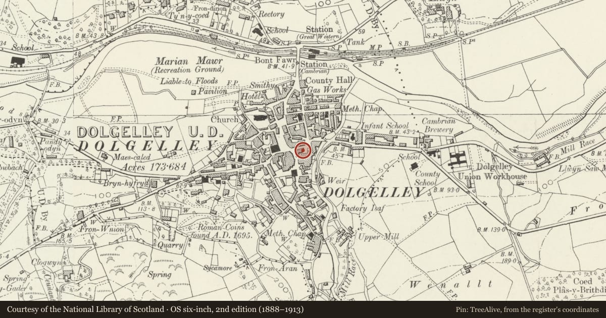
Slide toward Today to fade the historical sheet and see the modern map underneath.
David Rumsey Map Collection, Stanford LibrariesDavid Rumsey Map Collection, Stanford LibrariesDavid Rumsey Map Collection, Stanford LibrariesLlyfrgell Genedlaethol Cymru – The National Library of WalesDavid Rumsey Map Collection, Stanford Libraries
5 historical maps cover this location, the earliest the 1795 map "To Sir Watkin Williams-Wynn Bart ... the map of the six counties of North Wales is most humbly inscribed by his obedient humble servant" (Llyfrgell Genedlaethol Cymru – The National Library of Wales).
Historical maps covering this location
- 1795 · To Sir Watkin Williams-Wynn Bart ... the map of the six counties of North Wales is most… (Llyfrgell Genedlaethol Cymru – The National Library of Wales)
- 1883 · Watershed map England, Wales 3. (David Rumsey Map Collection, Stanford Libraries)
- 1896 · Sheet 7. Ordnance Survey of England and Wales. (David Rumsey Map Collection, Stanford Libraries)
- 1899 · 135 Harlech (Hills) (David Rumsey Map Collection, Stanford Libraries)
- 1901 · Sheet 9 and 10. (David Rumsey Map Collection, Stanford Libraries)
Cadw's description
Location
On the street line midway along.
History
Early-mid Cl9.
Exterior
L-shaped building with gable end bay advanced to street. 3ástorey, 3 window. Coursed rubble masonry, squared to advanced bay. Gently pitched slate roofs. Boxed eaves and verges, bargeboards.
Tripartite sashes to 2nd and lst floors of advanced bay 12 pane sashes flanked by narrow 4 pane sashes. Stone lintels. Modern shopfront to ground floor. Tripartite windows to flank of advanced bay; l6 small paned 2 light casement flanked by 8 pane fixed lights to 2nd floor under eaves. Tripartite sash as on front to lst floor, stone lintel. Shopfront returned to side.
Two l6 pane sash windows to 2nd and lst floors of right hand bay, stone lintels. Ground floor obscured by modern, flat roofed shop extension advanced to street.
Reason for designation
Group value.
Nearby in the register
- Siop EsgidiauCommercialunder 1 mi
- Dily's MeredithDomesticunder 1 mi
- Plas CochDomesticunder 1 mi
- The BakeryCommercialunder 1 mi
Other entries of the same register within about three miles of this one, by straight line.