Cof Cymru: National Historic Assets of Wales · Wales
Minffordd Cottage
Holywell, Flintshire, Wales
A Grade II listed building in Greenfield, Holywell, Flintshire, designated on 19 August 1991.
The record
- Designation
- Listed building, Grade II
- Broad class
- Domestic
- Date of designation
- 19 August 1991
- Locality
- Greenfield
- Community
- Holywell
- Unitary authority
- Flintshire
- Country
- Wales
- Coordinates
- 53.29164, -3.21280
- Cadw reference
- 497
Slide toward Today to fade the historical sheet and see the modern map underneath.
David Rumsey Map Collection, Stanford LibrariesDavid Rumsey Map Collection, Stanford LibrariesDavid Rumsey Map Collection, Stanford LibrariesLlyfrgell Genedlaethol Cymru – The National Library of WalesDavid Rumsey Map Collection, Stanford Libraries
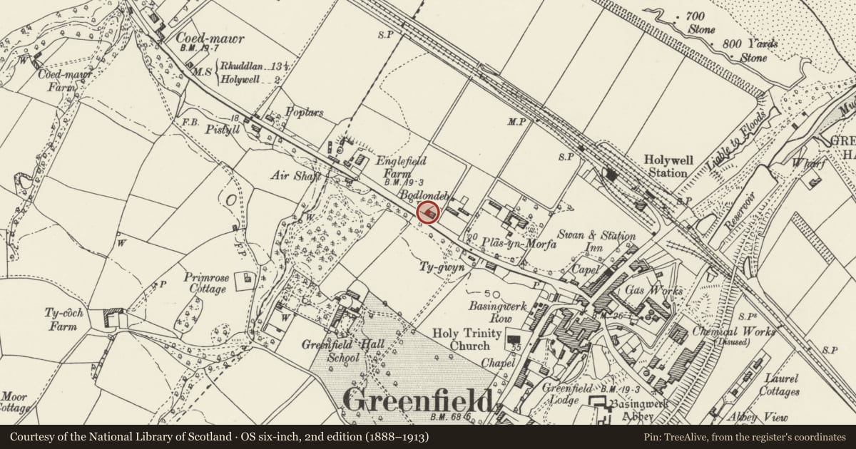
5 historical maps cover this location, the earliest the 1795 map "To Sir Watkin Williams-Wynn Bart ... the map of the six counties of North Wales is most humbly inscribed by his obedient humble servant" (Llyfrgell Genedlaethol Cymru – The National Library of Wales).
Historical maps covering this location
- 1795 · To Sir Watkin Williams-Wynn Bart ... the map of the six counties of North Wales is most… (Llyfrgell Genedlaethol Cymru – The National Library of Wales)
- 1830 · V.3:11-15:XV. Britisches Reich. A. Kon: England. b. Frstenthum Wales: Shire: 37-40 (David Rumsey Map Collection, Stanford Libraries)
- 1883 · Watershed map England, Wales 3. (David Rumsey Map Collection, Stanford Libraries)
- 1896 · 96 Liverpool (Hills) (David Rumsey Map Collection, Stanford Libraries)
- 1901 · Sheet 9 and 10. (David Rumsey Map Collection, Stanford Libraries)
Cadw's description
Location
Below the main coast road near the NW boudary of the Holywell Community Council area. Reached via main entrance to Bodlondeb Farm. Detached to NW.
History
Earlier C19 and built as a cottage for Plas-yn-Morfa of which Blondeb was the estate farm.
Exterior
2-storey, with Gothick glazing to the NE side; asbestos slate roof with wide eaves and central brick chimney stack. 2-window roughcast SW side facing the road; 2 and 3-light casement windows with high transoms to 1st floor, 6-pane sash and half-glazed door to ground floor. 3-window rendered NE side; camber-headed sliding sashes most of which are 2-light with intersecting Gothick heads, one partly altered; non-Gothick small-pane sliding sash to 1st floor left. Later lean-tos; 1-window W gable.
Reason for designation
Included for group value with Plas-yn-Morfa.
Nearby in the register
- Fomer Coach House & Stables at Plas-Yn-morfaDomesticunder 1 mi
- Plas-yn-MorfaDomesticunder 1 mi
- Holy Trinity ChurchReligious, Ritual and Funeraryunder 1 mi
- Signal Box at Holywell Junction Railway StationTransportunder 1 mi
Other entries of the same register within about three miles of this one, by straight line.