Cof Cymru: National Historic Assets of Wales · Wales
St Anne House
Barmouth, Gwynedd, Wales
A Grade II listed building in Barmouth, Gwynedd, designated on 3 April 1951.
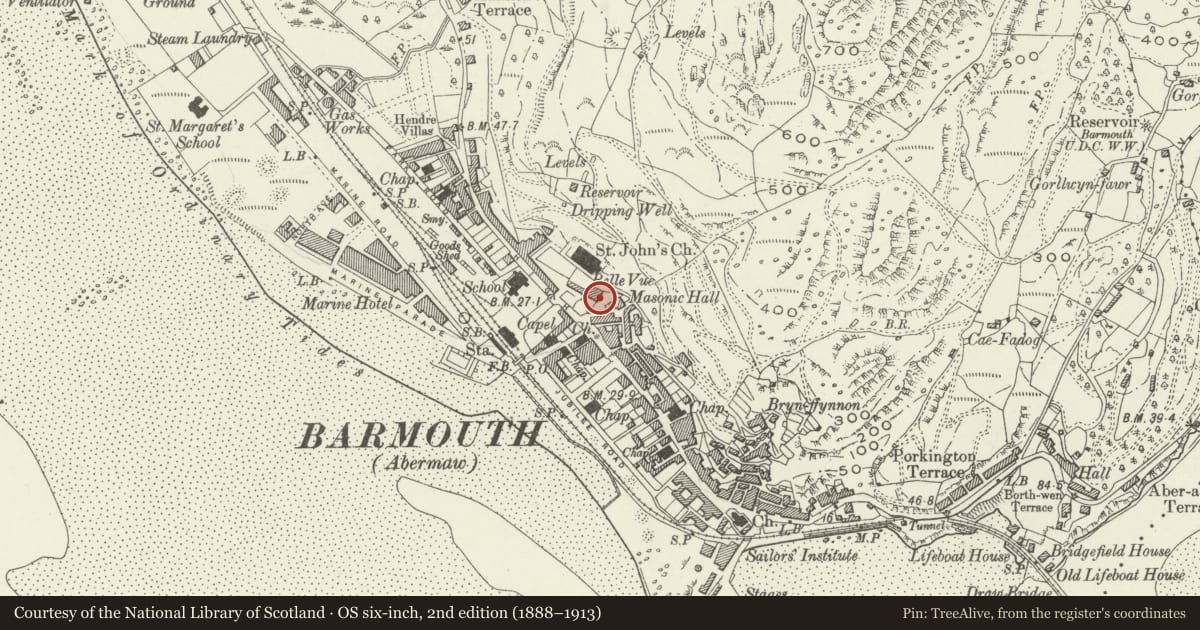
The record
- Designation
- Listed building, Grade II
- Broad class
- Commercial
- Date of designation
- 3 April 1951
- Locality
- Barmouth
- Community
- Barmouth
- Unitary authority
- Gwynedd
- Country
- Wales
- Coordinates
- 52.72282, -4.05459
- Cadw reference
- 4907
Slide toward Today to fade the historical sheet and see the modern map underneath.
David Rumsey Map Collection, Stanford LibrariesDavid Rumsey Map Collection, Stanford LibrariesDavid Rumsey Map Collection, Stanford LibrariesLlyfrgell Genedlaethol Cymru – The National Library of WalesDavid Rumsey Map Collection, Stanford Libraries
5 historical maps cover this location, the earliest the 1795 map "To Sir Watkin Williams-Wynn Bart ... the map of the six counties of North Wales is most humbly inscribed by his obedient humble servant" (Llyfrgell Genedlaethol Cymru – The National Library of Wales).
Historical maps covering this location
- 1795 · To Sir Watkin Williams-Wynn Bart ... the map of the six counties of North Wales is most… (Llyfrgell Genedlaethol Cymru – The National Library of Wales)
- 1883 · Watershed map England, Wales 3. (David Rumsey Map Collection, Stanford Libraries)
- 1896 · Sheet 7. Ordnance Survey of England and Wales. (David Rumsey Map Collection, Stanford Libraries)
- 1899 · 149 Barmouth (Hills) (David Rumsey Map Collection, Stanford Libraries)
- 1901 · Sheet 9 and 10. (David Rumsey Map Collection, Stanford Libraries)
Cadw's description
Location
Raised up on a terrace and set back to the N of the street; reached via a long flight of steps.
History
A large former Inn known originally as the Lion Inn, and subsequently as the Belle Vue. Built in the third quarter C18.
Exterior
A symmetrical 7 bay Georgian building of 3 storeys plus attic. Rough dressed stone construction with slate roof; rubble gable parapets and plain end stacks with weather coursing. Central recessed entrance with moulded wooden doorcase and Victorian 4-panel door with upper arched lights. C20 wooden pedimented porch on plain chamfered columns. Slightly recessed modern 12-pane sash-style windows. 3-baypediment to roof with multi-pane glazed oculus; plain C19 bargeboards and wooden finial. Bays 1 and 6 have deeply recessed (apparently C20)entrances to ground floor with modern part-glazed doors.
Reason for designation
A simple, well balanced Georgian Inn of historic interest to Barmouth and in a commanding position.
Group value with St. John's Church.
Nearby in the register
- St John's ChurchReligious, Ritual and Funeraryunder 1 mi
- Church HallRecreationalunder 1 mi
- TanyralltDomesticunder 1 mi
- Tanyrallt CottageDomesticunder 1 mi
Other entries of the same register within about three miles of this one, by straight line.