Cof Cymru: National Historic Assets of Wales · Wales
Tanyrallt
Barmouth, Gwynedd, Wales
A Grade II listed building in Barmouth, Gwynedd, designated on 31 January 1995.
The record
- Designation
- Listed building, Grade II
- Broad class
- Domestic
- Date of designation
- 31 January 1995
- Community
- Barmouth
- Unitary authority
- Gwynedd
- Country
- Wales
- Coordinates
- 52.72236, -4.05364
- Cadw reference
- 15470
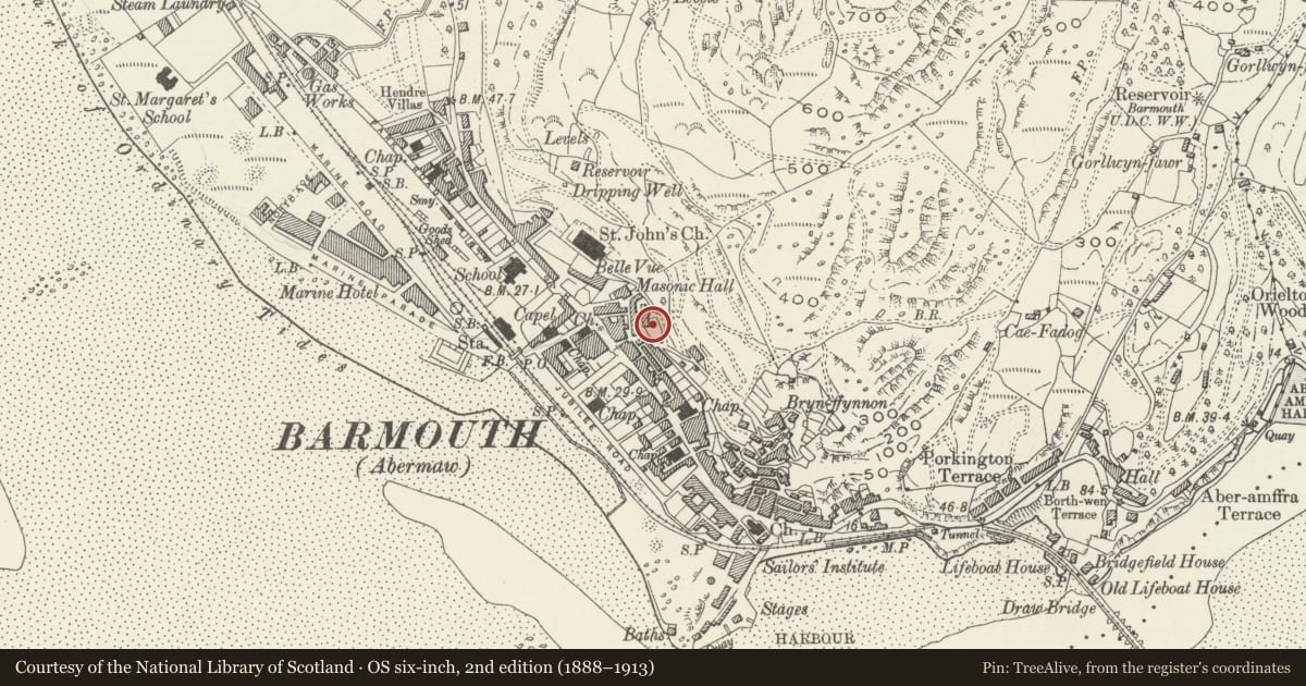
Slide toward Today to fade the historical sheet and see the modern map underneath.
David Rumsey Map Collection, Stanford LibrariesDavid Rumsey Map Collection, Stanford LibrariesDavid Rumsey Map Collection, Stanford LibrariesLlyfrgell Genedlaethol Cymru – The National Library of WalesDavid Rumsey Map Collection, Stanford Libraries
5 historical maps cover this location, the earliest the 1795 map "To Sir Watkin Williams-Wynn Bart ... the map of the six counties of North Wales is most humbly inscribed by his obedient humble servant" (Llyfrgell Genedlaethol Cymru – The National Library of Wales).
Historical maps covering this location
- 1795 · To Sir Watkin Williams-Wynn Bart ... the map of the six counties of North Wales is most… (Llyfrgell Genedlaethol Cymru – The National Library of Wales)
- 1883 · Watershed map England, Wales 3. (David Rumsey Map Collection, Stanford Libraries)
- 1896 · Sheet 7. Ordnance Survey of England and Wales. (David Rumsey Map Collection, Stanford Libraries)
- 1899 · 149 Barmouth (Hills) (David Rumsey Map Collection, Stanford Libraries)
- 1901 · Sheet 9 and 10. (David Rumsey Map Collection, Stanford Libraries)
Cadw's description
Location
Set against the hill side to the E of an unnamed lane which winds behind and above Water Street. Behind rubble garden walls with central wrought iron gate and plain flanking piers.
History
An early C19
Exterior
3 bay, 3 storey house; rubble construction with slate roof. Squat end chimneys with weather coursing; unkneelered stone- coped gable parapets. 3 modern skylights.
Rendered facade with late C19 stucco quoins and window surrounds. Central entrance with simple decorative stucco surround, as before. Original recessed 6-panel door with plain 3-pane rectangular fanlight above. Near-symmetrical fenestration: immediately to the L of the entrance a narrow recessed 4-pane sash window; the end bay and first-floor windows are recessed 12-pane sashes. 9-pane sashes to second floor. Cellar entrance via external stepped access beneath right-hand ground-floor window; plain modern stable door with plain iron railings.
Reason for designation
An early C19 house retaining its fenestration and contemporary door in a prominent location.
Group value with Tanyrallt Cottage.
Nearby in the register
- Tanyrallt CottageDomesticunder 1 mi
- Tan y GraigDomesticunder 1 mi
- The Cors-y-Gedol HotelCommercialunder 1 mi
- Walter Lloyd Jones & Co., Estate Agents, and Walter Lloyd Jones, SalesroomCommercialunder 1 mi
Other entries of the same register within about three miles of this one, by straight line.