Cof Cymru: National Historic Assets of Wales · Wales
Anchor Cottage
Barmouth, Gwynedd, Wales
A Grade II listed building in Barmouth, Gwynedd, designated on 3 April 1951.
The record
- Designation
- Listed building, Grade II
- Broad class
- Domestic
- Date of designation
- 3 April 1951
- Locality
- Barmouth
- Community
- Barmouth
- Unitary authority
- Gwynedd
- Country
- Wales
- Coordinates
- 52.71999, -4.05052
- Cadw reference
- 4899
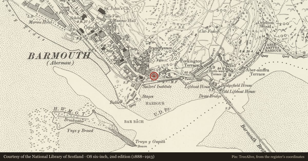
Slide toward Today to fade the historical sheet and see the modern map underneath.
David Rumsey Map Collection, Stanford LibrariesDavid Rumsey Map Collection, Stanford LibrariesDavid Rumsey Map Collection, Stanford LibrariesLlyfrgell Genedlaethol Cymru – The National Library of WalesDavid Rumsey Map Collection, Stanford Libraries
5 historical maps cover this location, the earliest the 1795 map "To Sir Watkin Williams-Wynn Bart ... the map of the six counties of North Wales is most humbly inscribed by his obedient humble servant" (Llyfrgell Genedlaethol Cymru – The National Library of Wales).
Historical maps covering this location
- 1795 · To Sir Watkin Williams-Wynn Bart ... the map of the six counties of North Wales is most… (Llyfrgell Genedlaethol Cymru – The National Library of Wales)
- 1883 · Watershed map England, Wales 3. (David Rumsey Map Collection, Stanford Libraries)
- 1896 · Sheet 7. Ordnance Survey of England and Wales. (David Rumsey Map Collection, Stanford Libraries)
- 1899 · 149 Barmouth (Hills) (David Rumsey Map Collection, Stanford Libraries)
- 1901 · Sheet 9 and 10. (David Rumsey Map Collection, Stanford Libraries)
Cadw's description
Location
On the street-line, partly set back behind a modern brick dwarf-walled forecourt/garden.
History
A late C17/early C18 house with added early C19 gabled wing to the L, the latter at right-angles with the street.
Exterior
Primary block: One-and-a-half storeys, of whitened rubble construction under a medium-pitched slate roof. Rubble chimneys, that to the L with simple capping and weather coursing. A tall rendered stack to the rear forms the end stack to a short gabled wing. This is now partly incorporated into a later (C19) house to the R. Symmetrical front with central entrance. Recessed modern 6-panelled door (upper 4 glazed). Modern 6-pane recessed casement-style windows to both floors, those to the attic contained within stone dormers which breakthe eaves. These with hipped roofs.
C19 Wing to the L: Construction as before. Plain street-facing gable with 2 windows as before (though larger), one diagonally-set above the other. To the L a C20 round-arched opening has been cut through. Thisgives on to a stepped, part-open passageway to the rear. The wing hasbeen reduced by the insertion of a brick wall to the R to screen thepassage.
Reason for designation
A good example of a local vernacular cottage in a prominent location on the main street.
Nearby in the register
- Graig FachDomesticunder 1 mi
- Quay CottageDomesticunder 1 mi
- Former Wash-House or Shop advanced to the R of Quay CottageCommercialunder 1 mi
- Graig FachDomesticunder 1 mi
Other entries of the same register within about three miles of this one, by straight line.