Cof Cymru: National Historic Assets of Wales · Wales
Graig Fach
Barmouth, Gwynedd, Wales
A Grade II listed building in Barmouth, Gwynedd, designated on 31 January 1995.
The record
- Designation
- Listed building, Grade II
- Broad class
- Domestic
- Date of designation
- 31 January 1995
- Community
- Barmouth
- Unitary authority
- Gwynedd
- Country
- Wales
- Coordinates
- 52.72008, -4.05001
- Cadw reference
- 15452
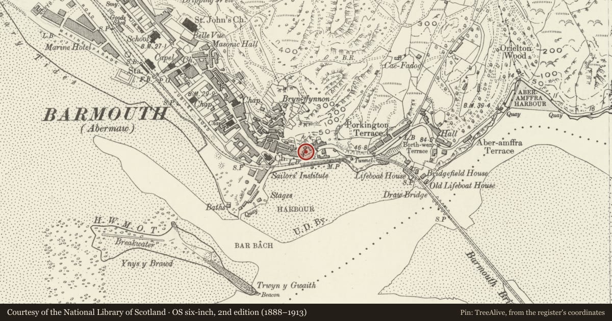
Slide toward Today to fade the historical sheet and see the modern map underneath.
David Rumsey Map Collection, Stanford LibrariesDavid Rumsey Map Collection, Stanford LibrariesDavid Rumsey Map Collection, Stanford LibrariesLlyfrgell Genedlaethol Cymru – The National Library of WalesDavid Rumsey Map Collection, Stanford Libraries
5 historical maps cover this location, the earliest the 1795 map "To Sir Watkin Williams-Wynn Bart ... the map of the six counties of North Wales is most humbly inscribed by his obedient humble servant" (Llyfrgell Genedlaethol Cymru – The National Library of Wales).
Historical maps covering this location
- 1795 · To Sir Watkin Williams-Wynn Bart ... the map of the six counties of North Wales is most… (Llyfrgell Genedlaethol Cymru – The National Library of Wales)
- 1883 · Watershed map England, Wales 3. (David Rumsey Map Collection, Stanford Libraries)
- 1896 · Sheet 7. Ordnance Survey of England and Wales. (David Rumsey Map Collection, Stanford Libraries)
- 1899 · 149 Barmouth (Hills) (David Rumsey Map Collection, Stanford Libraries)
- 1901 · Sheet 9 and 10. (David Rumsey Map Collection, Stanford Libraries)
Cadw's description
Location
Set back slightly behind a metalled forecourt with an adjacent petrol station to the R.
History
A terrace of 2 early C19 houses expressed as reflected units.
Exterior
Of coursed, rough-dressed stone with shallow-pitched modern slate roof. Plain eaves. Plain projecting end chimneys with weather coursing.
3 storeys, each with one window elevation. Recessed entrances with contemporary wooden doors and narrow diamond-latticed top-lights. Contemporary, slightly-recessed sash windows with projecting stone cills: those to first floors and ground floor R of 16 panes; those tosecond floor of 12. The left-hand house has a plain late C19 sash toits ground floor.
Interior
Largely unaltered this century; dog-leg stairs in both houses and slate floors to ground floor rooms. Plain simply moulded wooden fireplaces with later C19 ranges; 4-panelled Victorian doors.
Reason for designation
Included as a pair of largely unaltered houses in a prominent location.
Nearby in the register
- Graig FachDomesticunder 1 mi
- Anchor CottageDomesticunder 1 mi
- Quay CottageDomesticunder 1 mi
- Former Wash-House or Shop advanced to the R of Quay CottageCommercialunder 1 mi
Other entries of the same register within about three miles of this one, by straight line.