Cof Cymru: National Historic Assets of Wales · Wales
Tanyfron
Aberdaron, Gwynedd, Wales
A Grade II listed building in Anelog, Pwllheli, Aberdaron, Gwynedd, designated on 26 June 1989.
The record
- Designation
- Listed building, Grade II
- Broad class
- Domestic
- Date of designation
- 26 June 1989
- Locality
- Anelog
- Town
- Pwllheli
- Community
- Aberdaron
- Unitary authority
- Gwynedd
- Country
- Wales
- Coordinates
- 52.81461, -4.73940
- Cadw reference
- 4619
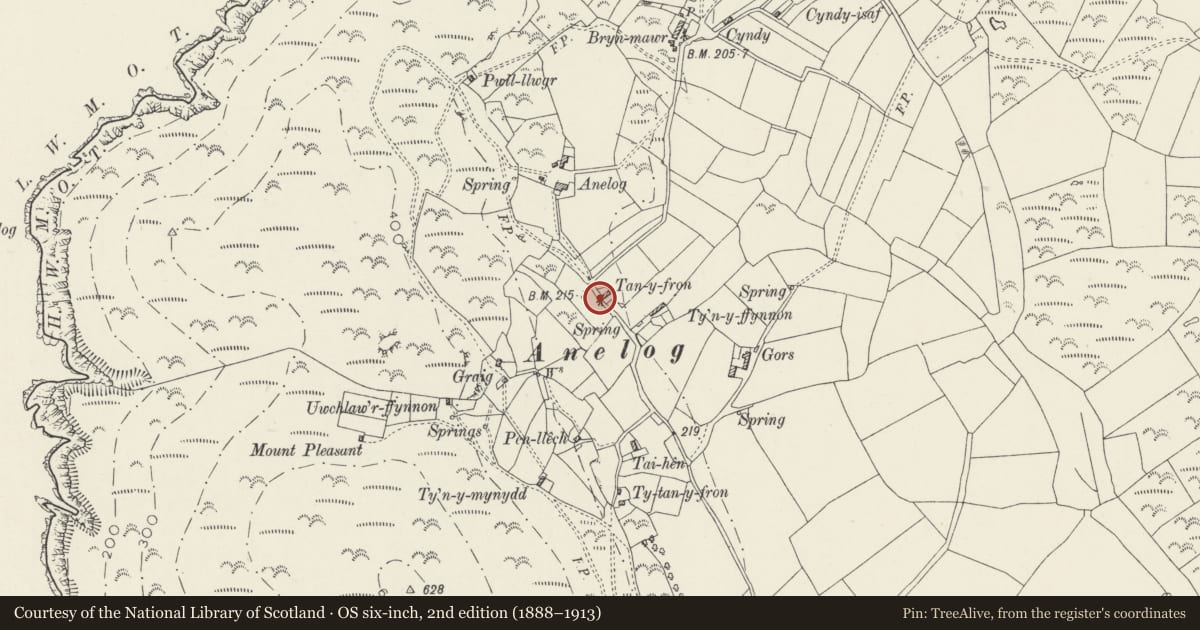
Slide toward Today to fade the historical sheet and see the modern map underneath.
David Rumsey Map Collection, Stanford LibrariesDavid Rumsey Map Collection, Stanford LibrariesDavid Rumsey Map Collection, Stanford LibrariesDavid Rumsey Map Collection, Stanford LibrariesDavid Rumsey Map Collection, Stanford Libraries
5 historical maps cover this location, the earliest the 1608 map "(13) Cambriae Typus." (David Rumsey Map Collection, Stanford Libraries).
Historical maps covering this location
- 1608 · (13) Cambriae Typus. (David Rumsey Map Collection, Stanford Libraries)
- 1637 · Particular description of Wales. Cambria seu Wallia (David Rumsey Map Collection, Stanford Libraries)
- 1799 · Ireland. (David Rumsey Map Collection, Stanford Libraries)
- 1883 · Watershed map England, Wales 3. (David Rumsey Map Collection, Stanford Libraries)
- 1898 · 133 Bardsey Island (Hills) (David Rumsey Map Collection, Stanford Libraries)
Cadw's description
Location
Situated at Anelog on E side of road some 600m N of Ty'n Anelog farm.
History
Small farmhouse, possibly later C18 in origin altered in C19 and gutted internally since 1989. The offset of the facade and big fireplace beam suggest a late C18 date, but it is probable that the house was raised as well as re-roofed in the C19. Owned by the National Trust. Not obviously marked on Tithe Map of 1844, though a house named as Ty'nyffynnon may be on the site.
Exterior
Farmhouse, rubble stone with purple slate roof, coped gables and stone C19 end stacks. Two-storey, double front much offset to right, indicating that left chimney was probably formerly a larger kitchen stack. Two first floor 4-pane sashes under eaves, ground floor 4-pane sash left, smaller 2-pane sash right and half-glazed door. Slab lintels to ground floor. Rear is outshut to right with side entry and one window under eaves. 4-pane sash under eaves to left.
To left of main front, former stable with grouted slate roof and 8-pane fixed-light window under eaves to right. Door to rear left. To right of main front, former cow-house, with slate roof (old grouted slates rear). Stable door to centre with slab lintel, window to right under eaves. Rear door and window part-blocked.
Interior
Interior entirely gutted at time of inspection. Cambered timber lintel to fireplace left and beam over entry to rear outshut. 2 C19 roof trusses. Cow-house has C19 truss, half-loft over E end with tongue-and-groove boarding, possibly once in domestic use.
Reason for designation
Included as a smaller vernacular farmhouse of C18 origins, with outbuildings in line.
Nearby in the register
- GraigDomesticunder 1 mi
- Capel AnelogChapelunder 1 mi
- Ty'n-y-mynyddDomesticunder 1 mi
- MountDomesticunder 1 mi
Other entries of the same register within about three miles of this one, by straight line.