Cof Cymru: National Historic Assets of Wales · Wales
The Whitehall
Pwllheli, Gwynedd, Wales
A Grade II listed building in Pwllheli, Gwynedd, designated on 28 July 1989.
The record
- Designation
- Listed building, Grade II
- Broad class
- Commercial
- Date of designation
- 28 July 1989
- Community
- Pwllheli
- Unitary authority
- Gwynedd
- Country
- Wales
- Coordinates
- 52.88931, -4.41888
- Cadw reference
- 4481
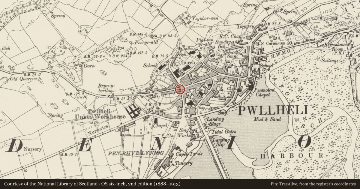
Slide toward Today to fade the historical sheet and see the modern map underneath.
David Rumsey Map Collection, Stanford LibrariesDavid Rumsey Map Collection, Stanford LibrariesDavid Rumsey Map Collection, Stanford LibrariesDavid Rumsey Map Collection, Stanford LibrariesDavid Rumsey Map Collection, Stanford Libraries
5 historical maps cover this location, the earliest the 1830 map "V.3:11-15:XV. Britisches Reich. A. Kon: England. b. Frstenthum Wales: Shire: 37-40" (David Rumsey Map Collection, Stanford Libraries).
Historical maps covering this location
- 1830 · V.3:11-15:XV. Britisches Reich. A. Kon: England. b. Frstenthum Wales: Shire: 37-40 (David Rumsey Map Collection, Stanford Libraries)
- 1883 · Watershed map England, Wales 3. (David Rumsey Map Collection, Stanford Libraries)
- 1896 · Sheet 7. Ordnance Survey of England and Wales. (David Rumsey Map Collection, Stanford Libraries)
- 1899 · 134 Pwllheli (Hills) (David Rumsey Map Collection, Stanford Libraries)
- 1901 · Sheet 9 and 10. (David Rumsey Map Collection, Stanford Libraries)
Cadw's description
Location
At the top of the street at the cross-roads with the High Street, set in the slope. Formerly the toll house.
History
1818 rebuilding and enlargement of an earlier structure probably C17/C18.
Exterior
2-storey painted coursed rubble 3-window front with plinth. Slate roof, wide boarded eaves and skylights; rubble end chimney stacks heightened in brick. A splayed corner has been created at a later date. 16-pane sash windows to 1st floor and C20 3-light bar windows below flanking round arched central entrance with deeply recessed doorway; 6 panel door. Cellar openings, boarded to left and barred to right. Set back to left is lower 2-storey range with similar materials; 3 light window to 1st floor and horned 12-pane sashes below. Further range behind. The right hand gable end facing Lleyn Street has similar window arrangements to that on the front; 1-window cross range beyond with small pane sash over glazed splayed bay with dentil cornice.
Reason for designation
Group value.
Nearby in the register
- 2 Lleyn StreetDomesticunder 1 mi
- AnchorageDomesticunder 1 mi
- Parry & SonsCommercialunder 1 mi
- 5 Gaol StreetCommercialunder 1 mi
Other entries of the same register within about three miles of this one, by straight line.