Cof Cymru: National Historic Assets of Wales · Wales
War Memorial
Pwllheli, Gwynedd, Wales
A Grade II listed building in Pwllheli, Gwynedd, designated on 28 July 1989.
The record
- Designation
- Listed building, Grade II
- Broad class
- Commemorative
- Date of designation
- 28 July 1989
- Community
- Pwllheli
- Unitary authority
- Gwynedd
- Country
- Wales
- Coordinates
- 52.88597, -4.41585
- Cadw reference
- 4480
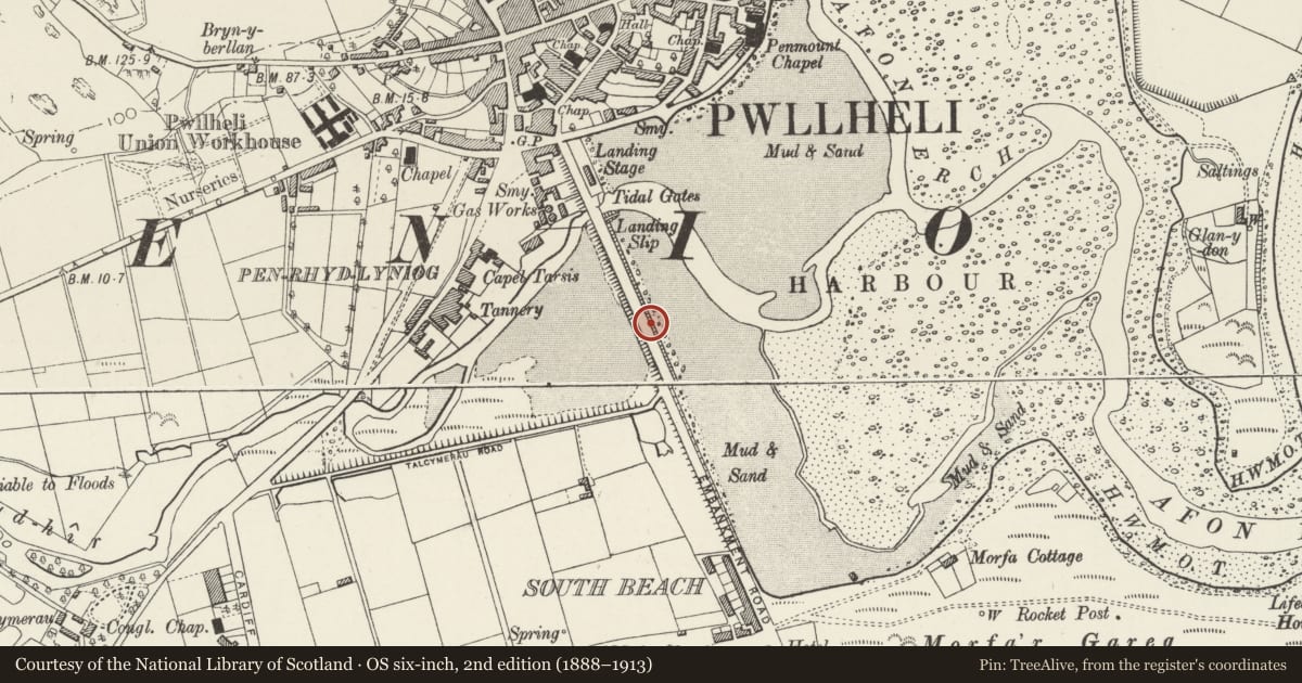
Slide toward Today to fade the historical sheet and see the modern map underneath.
David Rumsey Map Collection, Stanford LibrariesDavid Rumsey Map Collection, Stanford LibrariesDavid Rumsey Map Collection, Stanford LibrariesDavid Rumsey Map Collection, Stanford LibrariesDavid Rumsey Map Collection, Stanford Libraries
5 historical maps cover this location, the earliest the 1830 map "V.3:11-15:XV. Britisches Reich. A. Kon: England. b. Frstenthum Wales: Shire: 37-40" (David Rumsey Map Collection, Stanford Libraries).
Historical maps covering this location
- 1830 · V.3:11-15:XV. Britisches Reich. A. Kon: England. b. Frstenthum Wales: Shire: 37-40 (David Rumsey Map Collection, Stanford Libraries)
- 1883 · Watershed map England, Wales 3. (David Rumsey Map Collection, Stanford Libraries)
- 1896 · Sheet 7. Ordnance Survey of England and Wales. (David Rumsey Map Collection, Stanford Libraries)
- 1899 · 134 Pwllheli (Hills) (David Rumsey Map Collection, Stanford Libraries)
- 1901 · Sheet 9 and 10. (David Rumsey Map Collection, Stanford Libraries)
Cadw's description
Location
Set in semicircular enclosure at the roadside; inner harbour to E.
History
Unveiled 12 June 1924.
Exterior
Stepped granite platform and pedestal with broad cornice. Bronze figure of a soldier to top; bronze memorial plaques to both World Wars and to the Falklands War (1982). Unsigned.
Nearby in the register
- Pwllheli Railway StationTransportunder 1 mi
- L-Plan outbuildings to rear of Penlan Fawr P.H.Agriculture and Subsistenceunder 1 mi
- L-Plan outbuildings to rear of Penlan Fawr P.H.Domesticunder 1 mi
- CilcoedDomesticunder 1 mi
Other entries of the same register within about three miles of this one, by straight line.