Cof Cymru: National Historic Assets of Wales · Wales
Cilcoed
Pwllheli, Gwynedd, Wales
A Grade II listed building in Pwllheli, Gwynedd, designated on 28 July 1989.
The record
- Designation
- Listed building, Grade II
- Broad class
- Domestic
- Date of designation
- 28 July 1989
- Community
- Pwllheli
- Unitary authority
- Gwynedd
- Country
- Wales
- Coordinates
- 52.88872, -4.41731
- Cadw reference
- 4578
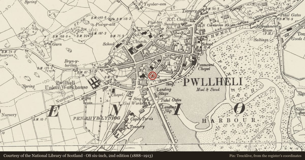
Slide toward Today to fade the historical sheet and see the modern map underneath.
David Rumsey Map Collection, Stanford LibrariesDavid Rumsey Map Collection, Stanford LibrariesDavid Rumsey Map Collection, Stanford LibrariesDavid Rumsey Map Collection, Stanford LibrariesDavid Rumsey Map Collection, Stanford Libraries
5 historical maps cover this location, the earliest the 1830 map "V.3:11-15:XV. Britisches Reich. A. Kon: England. b. Frstenthum Wales: Shire: 37-40" (David Rumsey Map Collection, Stanford Libraries).
Historical maps covering this location
- 1830 · V.3:11-15:XV. Britisches Reich. A. Kon: England. b. Frstenthum Wales: Shire: 37-40 (David Rumsey Map Collection, Stanford Libraries)
- 1883 · Watershed map England, Wales 3. (David Rumsey Map Collection, Stanford Libraries)
- 1896 · Sheet 7. Ordnance Survey of England and Wales. (David Rumsey Map Collection, Stanford Libraries)
- 1899 · 134 Pwllheli (Hills) (David Rumsey Map Collection, Stanford Libraries)
- 1901 · Sheet 9 and 10. (David Rumsey Map Collection, Stanford Libraries)
Cadw's description
Location
At the bottom of the street, stepped up to the right of Penlan Fawr PH. Railings and piers to front.
History
Mid to late C19 (Shown on 1889 OS map) rebuilding of earlier, possibly C18 house.
Exterior
Classically detailed 2-storey and basement 2 + 1-window rendered front with slate roof, wide eaves, coved cornice and cement rendered chimney stacks. Rusticated quoins, panelled entablature, cill bands and cornice over 1st floor. Horned 4-pane sashes with panelled architraves and bracket cornices. Additional window at extreme left end with rusticated border to the right. Bracket cornice also to elliptical arched main entrance; half glazed door with coloured glass side lights and fanlight with heraldic shield.
Decorative bargeboards to pebbledash right gable end; one small pane sash to 1st floor. 2-storey cross range to left with bracket pediment over the rear gable end 1st floor window sash with marginal glazing bars; bay window below with dentil cornice and coloured glass margins. Similar bay to main rear elevation. Good decorative bargeboards to rear porch with finial and pendant; segmental arched window with frosted glass. French windows with pedimented cornices and marginal glazing bars to inner side of cross range; cornice to right it largely mutilated.
Rubble walled and gated forecourt to right and rear; boarded door opening onto road.
Interior
Internally the cross range is of most interest; elaborate cornices with egg and dart, grapes and other foliage detail and large plaster ceiling roses.
Reason for designation
Group value.
Nearby in the register
- Penlan Fawr PHCommercialunder 1 mi
- Omar Khayam including former carriage entry to Penlan Fawr P.H.Commercialunder 1 mi
- L-Plan outbuildings to rear of Penlan Fawr P.H.Agriculture and Subsistenceunder 1 mi
- Siop Megan & Solicitors OfficeCommercialunder 1 mi
Other entries of the same register within about three miles of this one, by straight line.