Cof Cymru: National Historic Assets of Wales · Wales
Pen-y-clogwyn, including attached farm building
Porthmadog, Gwynedd, Wales
A Grade II listed building in Pen-y-clogwyn, Porthmadog, Gwynedd, designated on 1 April 1974.
The record
- Designation
- Listed building, Grade II
- Broad class
- Domestic
- Date of designation
- 1 April 1974
- Locality
- Pen-y-clogwyn
- Town
- Porthmadog
- Community
- Porthmadog
- Unitary authority
- Gwynedd
- Country
- Wales
- Coordinates
- 52.92284, -4.13505
- Cadw reference
- 4406
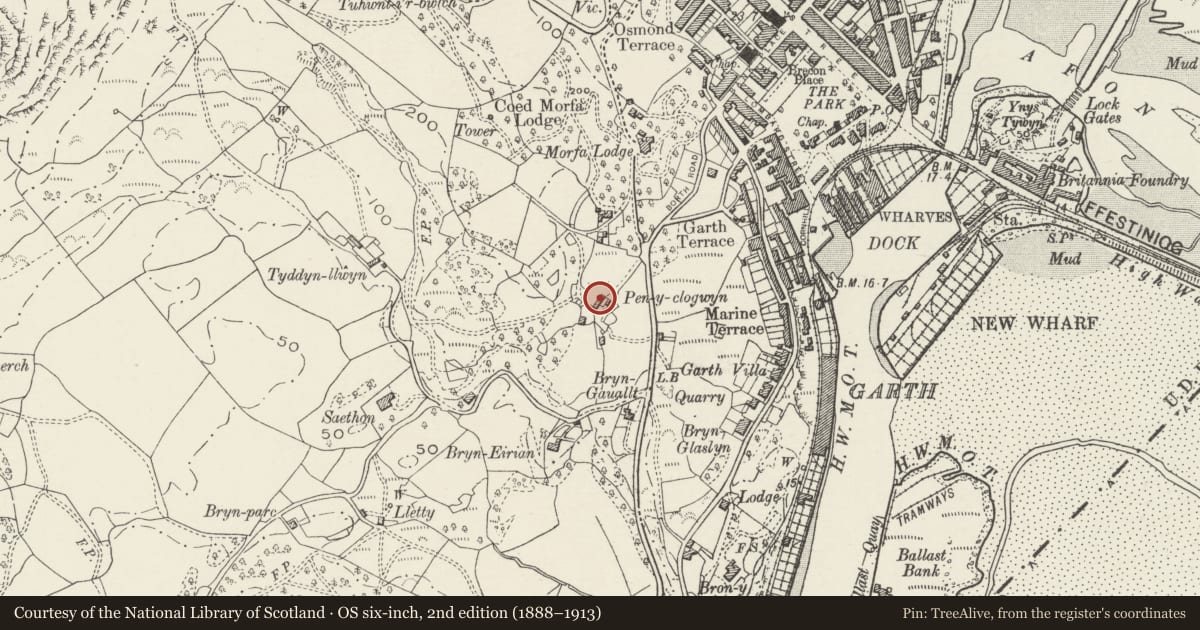
Slide toward Today to fade the historical sheet and see the modern map underneath.
David Rumsey Map Collection, Stanford LibrariesDavid Rumsey Map Collection, Stanford LibrariesDavid Rumsey Map Collection, Stanford LibrariesLlyfrgell Genedlaethol Cymru – The National Library of WalesDavid Rumsey Map Collection, Stanford Libraries
5 historical maps cover this location, the earliest the 1795 map "To Sir Watkin Williams-Wynn Bart ... the map of the six counties of North Wales is most humbly inscribed by his obedient humble servant" (Llyfrgell Genedlaethol Cymru – The National Library of Wales).
Historical maps covering this location
- 1795 · To Sir Watkin Williams-Wynn Bart ... the map of the six counties of North Wales is most… (Llyfrgell Genedlaethol Cymru – The National Library of Wales)
- 1883 · Watershed map England, Wales 3. (David Rumsey Map Collection, Stanford Libraries)
- 1896 · Sheet 7. Ordnance Survey of England and Wales. (David Rumsey Map Collection, Stanford Libraries)
- 1899 · 119 Snowdon (Hills) (David Rumsey Map Collection, Stanford Libraries)
- 1901 · Sheet 9 and 10. (David Rumsey Map Collection, Stanford Libraries)
Cadw's description
Location
Reached by a short farm road on the W side of Borth Road approximately 0.5km SW of Porthmadog town centre.
History
An C18 farmstead shown on the 1842 Tithe map.
Exterior
A 1½-storey farm house of whitened rubble stone, slate roof and stone end stacks, larger and original to the R and later to the L. The central entrance has a replacement half-glazed boarded door. It is flanked by replacement windows in earlier openings, of which the R hand is at a higher level due to the sloping site. Three late C19 gabled dormers have replacement 2-light casement windows and slate-hung sides.
Set back to the L is a lower outbuilding, probably a cow house originally, of whitened stone and slate roof. It has 2 replacement boarded doors, at higher level on the R side.
Interior
Not inspected.
Reason for designation
Listed for its special architectural interest as a well-preserved linear farmstead retaining good vernacular character.
Nearby in the register
- Gelli FaiaReligious, Ritual and Funeraryunder 1 mi
- Llwyn DerwNo class recordedunder 1 mi
- Church of the Most Holy RedeemerNo class recordedunder 1 mi
- Carreg Wen, Marine TerraceNo class recordedunder 1 mi
Other entries of the same register within about three miles of this one, by straight line.