Cof Cymru: National Historic Assets of Wales · Wales
Hendy and Ty Nant
Aberdaron, Gwynedd, Wales
A Grade II listed building in Yr Enlli / Bardsey Island, Pwllheli, Aberdaron, Gwynedd, designated on 20 February 1974.
The record
- Designation
- Listed building, Grade II
- Broad class
- Domestic
- Date of designation
- 20 February 1974
- Locality
- Yr Enlli / Bardsey Island
- Town
- Pwllheli
- Community
- Aberdaron
- Unitary authority
- Gwynedd
- Country
- Wales
- Coordinates
- 52.76456, -4.78759
- Cadw reference
- 4394
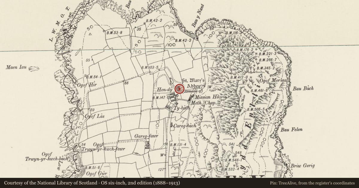
Slide toward Today to fade the historical sheet and see the modern map underneath.
David Rumsey Map Collection, Stanford LibrariesDavid Rumsey Map Collection, Stanford LibrariesDavid Rumsey Map Collection, Stanford LibrariesDavid Rumsey Map Collection, Stanford LibrariesDavid Rumsey Map Collection, Stanford Libraries
5 historical maps cover this location, the earliest the 1608 map "(13) Cambriae Typus." (David Rumsey Map Collection, Stanford Libraries).
Historical maps covering this location
- 1608 · (13) Cambriae Typus. (David Rumsey Map Collection, Stanford Libraries)
- 1637 · Particular description of Wales. Cambria seu Wallia (David Rumsey Map Collection, Stanford Libraries)
- 1799 · Ireland. (David Rumsey Map Collection, Stanford Libraries)
- 1883 · Watershed map England, Wales 3. (David Rumsey Map Collection, Stanford Libraries)
- 1898 · 133 Bardsey Island (Hills) (David Rumsey Map Collection, Stanford Libraries)
Cadw's description
Location
Situated just N of the Newborough cross towards N end of the island.
History
Pair of farmhouses built c1870-75 as part of the general rebuilding of the farms on the island by the third Baron Newborough, similar to the 3 other semi-detached pairs: Ty Nant/Ty Nesaf, Cristin, and Ty Pella/Rhedynog Goch.
Exterior
Pair of semi-detached farmhouses, Hendy to N, Ty Nant to S, whitewashed render with close-eaved slate steep roof and 3 brick ridge stacks. Slate copings to gables. One and a half storeys, 4-window W front with projecting cross-wing each side. Windows were originally small-paned with timber mullions and transoms, but most are altered in C20. Crosswings have C20 window each floor and a shallow porch against inner return wall with slate roof, square headed opening and ledged door within. Two 3-light windows to centre, the left one original. S end wall has window each floor. Rear wall is rubble stone with similar shallow porch central to each house.
Reason for designation
Included as little altered pair of Newborough estate farmhouses to a distinctive design, of group value with the other buildings around the Abbey ruin.
Nearby in the register
- Boundary Walls to Hendy and Ty NantDomesticunder 1 mi
- Walled Enclosure to Newborough CrossReligious, Ritual and Funeraryunder 1 mi
- Newborough CrossReligious, Ritual and Funeraryunder 1 mi
- Graveyard Wall to Abbey of St MaryReligious, Ritual and Funeraryunder 1 mi
Other entries of the same register within about three miles of this one, by straight line.