Cof Cymru: National Historic Assets of Wales · Wales
Walled Enclosure to Newborough Cross
Aberdaron, Gwynedd, Wales
A Grade II listed building in Yr Enlli / Bardsey Island, Aberdaron, Gwynedd, designated on 26 June 1998.
The record
- Designation
- Listed building, Grade II
- Broad class
- Religious, Ritual and Funerary
- Date of designation
- 26 June 1998
- Locality
- Yr Enlli / Bardsey Island
- Community
- Aberdaron
- Unitary authority
- Gwynedd
- Country
- Wales
- Coordinates
- 52.76444, -4.78767
- Cadw reference
- 20053
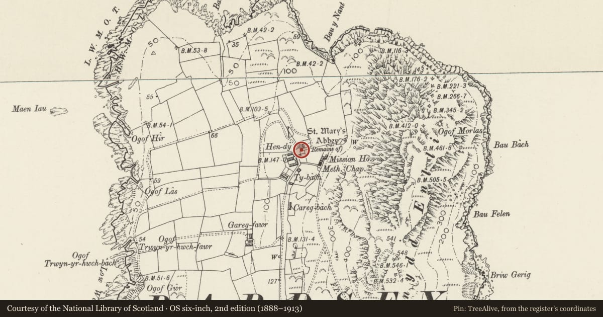
Slide toward Today to fade the historical sheet and see the modern map underneath.
David Rumsey Map Collection, Stanford LibrariesDavid Rumsey Map Collection, Stanford LibrariesDavid Rumsey Map Collection, Stanford LibrariesDavid Rumsey Map Collection, Stanford LibrariesDavid Rumsey Map Collection, Stanford Libraries
5 historical maps cover this location, the earliest the 1608 map "(13) Cambriae Typus." (David Rumsey Map Collection, Stanford Libraries).
Historical maps covering this location
- 1608 · (13) Cambriae Typus. (David Rumsey Map Collection, Stanford Libraries)
- 1637 · Particular description of Wales. Cambria seu Wallia (David Rumsey Map Collection, Stanford Libraries)
- 1799 · Ireland. (David Rumsey Map Collection, Stanford Libraries)
- 1883 · Watershed map England, Wales 3. (David Rumsey Map Collection, Stanford Libraries)
- 1898 · 133 Bardsey Island (Hills) (David Rumsey Map Collection, Stanford Libraries)
Cadw's description
Location
Walled roughly square enclosure around the Newborough cross.
History
Walled enclosure, presumably of 1891 when the cross was erected, but similar to the other walls erected in the late C19 by the Newborough estate.
Exterior
Walls enclosing square area around the cross, rubble stone with squared stone cappings and two square gatepiers at W entry with raised band below cap.
Reason for designation
Included for group value with the cross and neighbouring Abbey ruin, and part of the pattern of stone-walled enclosures which is a characteristic feature of the Bardsey landscape.
Nearby in the register
- Newborough CrossReligious, Ritual and Funeraryunder 1 mi
- Ruin of Abbey of St MaryReligious, Ritual and Funeraryunder 1 mi
- St Mary's Abbey, Bardsey IslandAbbeyunder 1 mi
- Hendy and Ty NantDomesticunder 1 mi
Other entries of the same register within about three miles of this one, by straight line.