Cof Cymru: National Historic Assets of Wales · Wales
Trallwyn Hall
Llannor, Gwynedd, Wales
A Grade II listed building in Llwyndyrys, Pwllheli, Llannor, Gwynedd, designated on 19 October 1971.
The record
- Designation
- Listed building, Grade II
- Broad class
- Domestic
- Date of designation
- 19 October 1971
- Locality
- Llwyndyrys
- Town
- Pwllheli
- Community
- Llannor
- Unitary authority
- Gwynedd
- Country
- Wales
- Coordinates
- 52.94398, -4.40515
- Cadw reference
- 4324
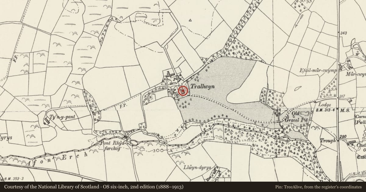
Slide toward Today to fade the historical sheet and see the modern map underneath.
David Rumsey Map Collection, Stanford LibrariesDavid Rumsey Map Collection, Stanford LibrariesDavid Rumsey Map Collection, Stanford LibrariesDavid Rumsey Map Collection, Stanford LibrariesLlyfrgell Genedlaethol Cymru – The National Library of Wales
5 historical maps cover this location, the earliest the 1795 map "To Sir Watkin Williams-Wynn Bart ... the map of the six counties of North Wales is most humbly inscribed by his obedient humble servant" (Llyfrgell Genedlaethol Cymru – The National Library of Wales).
Historical maps covering this location
- 1795 · To Sir Watkin Williams-Wynn Bart ... the map of the six counties of North Wales is most… (Llyfrgell Genedlaethol Cymru – The National Library of Wales)
- 1883 · Watershed map England, Wales 3. (David Rumsey Map Collection, Stanford Libraries)
- 1896 · Sheet 7. Ordnance Survey of England and Wales. (David Rumsey Map Collection, Stanford Libraries)
- 1899 · 118 Nevin (Hills) (David Rumsey Map Collection, Stanford Libraries)
- 1901 · Sheet 9 and 10. (David Rumsey Map Collection, Stanford Libraries)
Cadw's description
Location
The building stands in its own grounds, approached by two long avenues off the main Pwllheli to Caernarfon Road, of which only the southern is now in use.
History
Probably built in the early C19, and replacing a late C16-early C17 house on the site. A date of 1602 is said to be visible at the rear (not seen).
Exterior
Built of rubble stonework and rendered, lined out and painted. Slate roof with wide boxed eaves. The plan consists of a main S range the hipped roof returning both sides divided by a central valley gutter, the W range curiously higher and half-hipped both ends. The main entrance is on the E elevation, 5 bays with a round arched doorway placed centrally with panelled doors, partly glazed, and a radial fanlight over. Added porch. Twelve-paned sash windows to the ground floor and 9-pane to the upper floor. The garden elevation is of 5 bays, with a raised slated veranda attached to the front supported on slender Tuscan columns. On the N side (not seen) a reset stone inscribed 1602 / DLL EO, for Dafydd Lloyd and Elizabeth Owen.
Reason for designation
Included, notwithstanding the present condition, as a good example of a small early C19 non-vernacular country house.
Nearby in the register
- LlwyndyrusDomesticunder 1 mi
- Hammel Range at LlwyndyrusAgriculture and Subsistenceunder 1 mi
- Farm Building at LlwyndyrusAgriculture and Subsistenceunder 1 mi
- Cowhouse and Barn Range at LlwyndyrusAgriculture and Subsistenceunder 1 mi
Other entries of the same register within about three miles of this one, by straight line.