Cof Cymru: National Historic Assets of Wales · Wales
Hammel Range at Llwyndyrus
Llannor, Gwynedd, Wales
A Grade II listed building in Llwyndyrys, Pwllheli, Llannor, Gwynedd, designated on 8 February 1999.
The record
- Designation
- Listed building, Grade II
- Broad class
- Agriculture and Subsistence
- Date of designation
- 8 February 1999
- Locality
- Llwyndyrys
- Town
- Pwllheli
- Community
- Llannor
- Unitary authority
- Gwynedd
- Country
- Wales
- Coordinates
- 52.93908, -4.40474
- Cadw reference
- 21360
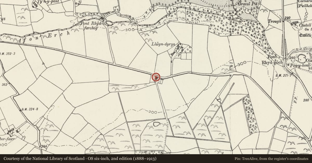
Slide toward Today to fade the historical sheet and see the modern map underneath.
David Rumsey Map Collection, Stanford LibrariesDavid Rumsey Map Collection, Stanford LibrariesDavid Rumsey Map Collection, Stanford LibrariesDavid Rumsey Map Collection, Stanford LibrariesLlyfrgell Genedlaethol Cymru – The National Library of Wales
5 historical maps cover this location, the earliest the 1795 map "To Sir Watkin Williams-Wynn Bart ... the map of the six counties of North Wales is most humbly inscribed by his obedient humble servant" (Llyfrgell Genedlaethol Cymru – The National Library of Wales).
Historical maps covering this location
- 1795 · To Sir Watkin Williams-Wynn Bart ... the map of the six counties of North Wales is most… (Llyfrgell Genedlaethol Cymru – The National Library of Wales)
- 1883 · Watershed map England, Wales 3. (David Rumsey Map Collection, Stanford Libraries)
- 1896 · Sheet 7. Ordnance Survey of England and Wales. (David Rumsey Map Collection, Stanford Libraries)
- 1899 · 118 Nevin (Hills) (David Rumsey Map Collection, Stanford Libraries)
- 1901 · Sheet 9 and 10. (David Rumsey Map Collection, Stanford Libraries)
Cadw's description
Location
The farm yard for cattle at Llwyndyrus stands apart from the farm and alongside the road running W from Y Ffor. The hammel range backs on to the road and is in line with the earlier farm building.
History
The range was probably erected in the early-mid C19 as part of the development of a yard associated with an earlier farm building against the road.
Exterior
The building is constructed with boulder stonework, with an old irregular sized slate roof. Five bays, with low stone-lintelled openings directly under the low eaves, separated by piers on the S front, opening to a walled front area.
Reason for designation
Included as a well-preserved example of a hammel, and as an element of the complete and largely unaltered C19 cattle farm yard at Llwyndyrus, set away from the farmhouse.
Nearby in the register
- Farm Building at LlwyndyrusAgriculture and Subsistenceunder 1 mi
- Cowhouse and Barn Range at LlwyndyrusAgriculture and Subsistenceunder 1 mi
- LlwyndyrusDomesticunder 1 mi
- Trallwyn HallDomesticunder 1 mi
Other entries of the same register within about three miles of this one, by straight line.