Cof Cymru: National Historic Assets of Wales · Wales
Penhyddgan
Buan, Gwynedd, Wales
A Grade II* listed building in Ceidio, Pwllheli, Buan, Gwynedd, designated on 19 October 1971.
The record
- Designation
- Listed building, Grade II*
- Broad class
- Domestic
- Date of designation
- 19 October 1971
- Locality
- Ceidio
- Town
- Pwllheli
- Community
- Buan
- Unitary authority
- Gwynedd
- Country
- Wales
- Coordinates
- 52.91855, -4.52641
- Cadw reference
- 4269
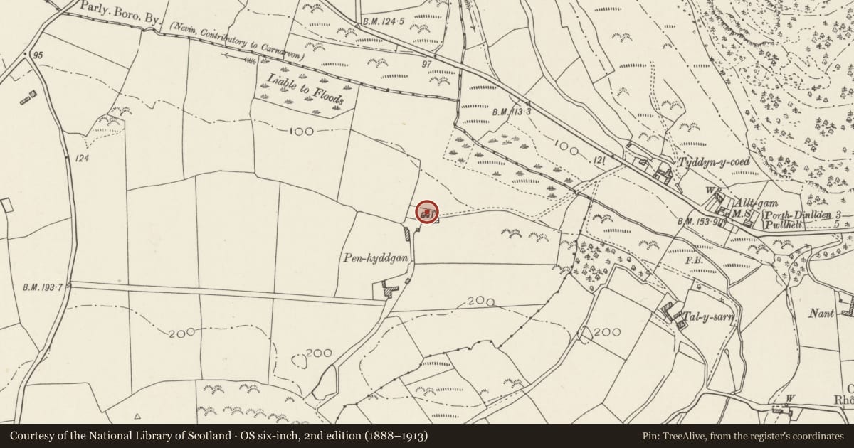
Slide toward Today to fade the historical sheet and see the modern map underneath.
David Rumsey Map Collection, Stanford LibrariesDavid Rumsey Map Collection, Stanford LibrariesDavid Rumsey Map Collection, Stanford LibrariesDavid Rumsey Map Collection, Stanford LibrariesDavid Rumsey Map Collection, Stanford Libraries
5 historical maps cover this location, the earliest the 1608 map "(13) Cambriae Typus." (David Rumsey Map Collection, Stanford Libraries).
Historical maps covering this location
- 1608 · (13) Cambriae Typus. (David Rumsey Map Collection, Stanford Libraries)
- 1830 · V.3:11-15:XV. Britisches Reich. A. Kon: England. b. Frstenthum Wales: Shire: 37-40 (David Rumsey Map Collection, Stanford Libraries)
- 1883 · Watershed map England, Wales 3. (David Rumsey Map Collection, Stanford Libraries)
- 1899 · 118 Nevin (Hills) (David Rumsey Map Collection, Stanford Libraries)
- 1901 · Sheet 9 and 10. (David Rumsey Map Collection, Stanford Libraries)
Cadw's description
Location
Situated some 2 km E of Ceidio church and approached by drive running SW from the A497 NW of Boduan.
History
Sub-medieval farmhouse thought to date from the later C16 (perhaps c1580). The house formed part of the Madryn estate by 1783. C20 extension, but the house has otherwise survived little changed.
Exterior
Farmhouse. 2 storeys, 2-unit plan with projecting staircase wing. Down-slope siting, with principal room at upper end. Granite rubble walls (pebble-dash on gable end), slate roofs and gable-end stacks, rendered bases with the brick shafts rebuilt c1990. Lean-to C20 addition against lower end. East elevation has staircase wing set to right, with single 9-paned window in gable apex, and entrance in its S return in roughly segmental arched doorway with C20 oak panelled door. Tripartite sash window lighting principal room to left, and 16-pane sash to first floor above. C20 lean-to abuts the staircase wing on its right side, and wraps around the lower gable of the house, in part at least possibly replacing an earlier (perhaps C18) addition. West elevation has inserted small-paned door towards left (presumably marking the site of an earlier window), and rough-arched doorway partially blocked and now a window to left of centre (aligned with the east entrance in the stair wing). Tripartite sash window to the right. Small former stair light to right at first floor, and 6- and 9-pane sashes aligned with lower right hand window and original doorway. Upper left window is unaligned, a wide small-paned casement. Present entrance in C20 lean-to against lower gable.
Interior
Simple 2-roomed plan comprising main hall formerly with opposed entrances, and parlour, the two separated by a fine screen with 4-centred arched doorways to each side (one now blocked). Screen modified by insertion at some time of two modern doorways, subsequently removed and panelling re-instated. Guilloche moulding to original lengths of mid-rail, and reeded mouldings to lintels and upper rails, echoed in similar moulding to the fire-lintel, and the joists (though many have been turned). Heavy chamfered main beams. Deep fireplace flanked by closet to left, and possible site of stair (since removed) to right. Some similar decoration to joists in former parlour. Position, though not detail, of parlour fireplace, has been retained. Renewed spiral stair in projecting wing, which continues slightly beyond the first floor level. C20 door into hall, and older door now giving access to C20 extension, but presumably formerly serving an earlier addition to the house. Layout of first floor now altered by later sub-division. Curved bases of roof trusses visible below ceilings. Room over hall formerly open to the roof, evidenced by the fine decoration applied to this truss: ornate cusped bracing to collar, raking struts and principal rafters. The second truss is of similar form, but is undecorated. Large-scantling through-purlins laid flat on trusses.
Reason for designation
Listed Grade II* as an exceptionally complete late C16 farmhouse of high status, with particularly good surviving interior features.
Nearby in the register
- The Cock-loftDomesticunder 1 mi
- MilestoneTransportunder 1 mi
- Tan-y-fronDomesticunder 1 mi
- Tan-y-fronDomesticunder 1 mi
Other entries of the same register within about three miles of this one, by straight line.