Cof Cymru: National Historic Assets of Wales · Wales
Church of St Maelrhys
Aberdaron, Gwynedd, Wales
A Grade II listed building in Llanfaelrhys, Pwllheli, Aberdaron, Gwynedd, designated on 19 October 1971.
The record
- Designation
- Listed building, Grade II
- Broad class
- Religious, Ritual and Funerary
- Date of designation
- 19 October 1971
- Locality
- Llanfaelrhys
- Town
- Pwllheli
- Community
- Aberdaron
- Unitary authority
- Gwynedd
- Country
- Wales
- Coordinates
- 52.80930, -4.65702
- Cadw reference
- 4236
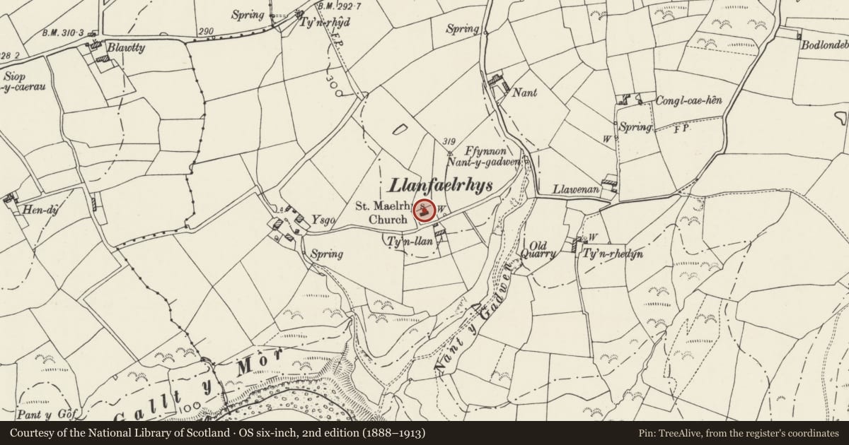
Slide toward Today to fade the historical sheet and see the modern map underneath.
David Rumsey Map Collection, Stanford LibrariesDavid Rumsey Map Collection, Stanford LibrariesDavid Rumsey Map Collection, Stanford LibrariesDavid Rumsey Map Collection, Stanford LibrariesDavid Rumsey Map Collection, Stanford Libraries
5 historical maps cover this location, the earliest the 1608 map "(13) Cambriae Typus." (David Rumsey Map Collection, Stanford Libraries).
Historical maps covering this location
- 1608 · (13) Cambriae Typus. (David Rumsey Map Collection, Stanford Libraries)
- 1830 · V.3:11-15:XV. Britisches Reich. A. Kon: England. b. Frstenthum Wales: Shire: 37-40 (David Rumsey Map Collection, Stanford Libraries)
- 1883 · Watershed map England, Wales 3. (David Rumsey Map Collection, Stanford Libraries)
- 1898 · 133 Bardsey Island (Hills) (David Rumsey Map Collection, Stanford Libraries)
- 1901 · Sheet 9 and 10. (David Rumsey Map Collection, Stanford Libraries)
Cadw's description
Location
Situated on N side of minor lane running S and E off Aberdaron-Rhiw road from junction at Penycaerau.
History
Parish church of medieval origins, extended to E at an uncertain date and with C19 windows, door and W bellcote. The interior still has pre-Victorian box-pews and benches.
Exterior
Parish church, rubble stone with single slate roof and C19 W bellcote in squared stone with slate-capped gable and single arched opening. Coped E gable. Massive boulder footings suggest medieval origins, but W wall appears rebuilt except for cornerstones. W arched doorway with stone voussoirs and double ledged doors. Narrow arched light each side and another high in gable. Within doorway is passage with doors right and left and double doors into nave. N wall has blocked door to W end, roughly pointed with stone voussoirs. S wall has two C19 cross-windows, small-paned with one quarter opening. On S wall is another blocked door with segmental head, probably not medieval.
Interior
Plastered walls, 5-bay C19 roof of pine wishbone trusses. Set-back in N wall possibly indicating original E end. Two steps to sanctuary, plain rails and crude timber pulpit. 12 box pews on side with panelled doors and bench at W end. N side has 8 backless benches linked by a bench along wall. 5 bench-ends inscribed 'Nanhoron'. Then 2 box pews, lower than those on S. Medieval font, irregular octagonal bowl, whitewashed with cross on one face, ring mould around shaft and splayed base.
Reason for designation
A simple vernacular church retaining late Georgian box pews and benches.
Nearby in the register
- Barn and Stable Range at BlawdtyAgriculture and Subsistenceunder 1 mi
- Pigsties at BlawdtyAgriculture and Subsistenceunder 1 mi
- BlawdtyDomesticunder 1 mi
- Plas IolDomesticunder 1 mi
Other entries of the same register within about three miles of this one, by straight line.