Cof Cymru: National Historic Assets of Wales · Wales
Plas Iol
Aberdaron, Gwynedd, Wales
A Grade II listed building in Penycaerau, Pwllheli, Aberdaron, Gwynedd, designated on 26 June 1998.
The record
- Designation
- Listed building, Grade II
- Broad class
- Domestic
- Date of designation
- 26 June 1998
- Locality
- Penycaerau
- Town
- Pwllheli
- Community
- Aberdaron
- Unitary authority
- Gwynedd
- Country
- Wales
- Coordinates
- 52.81867, -4.66183
- Cadw reference
- 20015
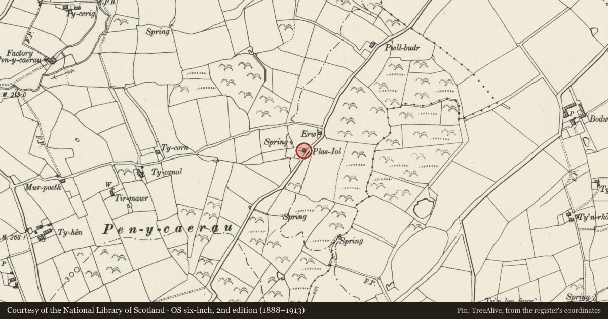
Slide toward Today to fade the historical sheet and see the modern map underneath.
David Rumsey Map Collection, Stanford LibrariesDavid Rumsey Map Collection, Stanford LibrariesDavid Rumsey Map Collection, Stanford LibrariesDavid Rumsey Map Collection, Stanford LibrariesDavid Rumsey Map Collection, Stanford Libraries
5 historical maps cover this location, the earliest the 1608 map "(13) Cambriae Typus." (David Rumsey Map Collection, Stanford Libraries).
Historical maps covering this location
- 1608 · (13) Cambriae Typus. (David Rumsey Map Collection, Stanford Libraries)
- 1830 · V.3:11-15:XV. Britisches Reich. A. Kon: England. b. Frstenthum Wales: Shire: 37-40 (David Rumsey Map Collection, Stanford Libraries)
- 1883 · Watershed map England, Wales 3. (David Rumsey Map Collection, Stanford Libraries)
- 1898 · 133 Bardsey Island (Hills) (David Rumsey Map Collection, Stanford Libraries)
- 1901 · Sheet 9 and 10. (David Rumsey Map Collection, Stanford Libraries)
Cadw's description
Location
Situated on W side of road from Blawdty towards Meilionydd Mawr, some 800m NNE of junction at Blawdty.
History
Croglofft cottage, probably earlier to mid C19, said to have been called Erw, the name moved to modern house just N, the present name derived from a father and son who owned it for some 100 years. Not apparently marked on 1844 Tithe Map, when Erw, on a different site was owned by William Williams, occupied by William Parry.
Exterior
Cottage, whitewashed rubble stone with roof of small grouted slates and whitewashed stone end stacks with dripstones, the S end stack is larger and facade is offset left. Single storey, part-lofted within, double-fronted with 9-pane casement left, ledged door centre and fixed 9-pane window right. Slab lintels. Rear wall to road has small 4-pane sash left and 4-pane casement right.
Interior
Croglofft over N end, S end fireplace with stone slab lintel. Collar-truss roof.
Reason for designation
Included as a good example of the small croglofft cottage typical of the region, retaining its character in materials, scale of detail, and internal layout.
Nearby in the register
- Bodwyddog BachDomesticunder 1 mi
- Pigsties at BlawdtyAgriculture and Subsistenceunder 1 mi
- BlawdtyDomesticunder 1 mi
- Barn and Stable Range at BlawdtyAgriculture and Subsistenceunder 1 mi
Other entries of the same register within about three miles of this one, by straight line.