Cof Cymru: National Historic Assets of Wales · Wales
St Marys Parish Church
Bangor, Gwynedd, Wales
A Grade II listed building in Bangor, Gwynedd, designated on 2 August 1988.
The record
- Designation
- Listed building, Grade II
- Broad class
- Religious, Ritual and Funerary
- Date of designation
- 2 August 1988
- Community
- Bangor
- Unitary authority
- Gwynedd
- Country
- Wales
- Coordinates
- 53.23028, -4.12368
- Cadw reference
- 3986
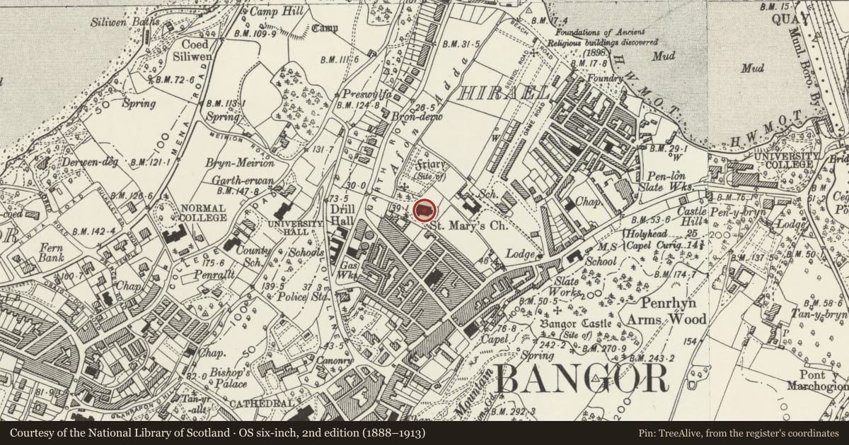
Slide toward Today to fade the historical sheet and see the modern map underneath.
David Rumsey Map Collection, Stanford LibrariesDavid Rumsey Map Collection, Stanford LibrariesDavid Rumsey Map Collection, Stanford LibrariesDavid Rumsey Map Collection, Stanford LibrariesDavid Rumsey Map Collection, Stanford Libraries
5 historical maps cover this location, the earliest the 1896 map "Sheet 7. Ordnance Survey of England and Wales." (David Rumsey Map Collection, Stanford Libraries).
Historical maps covering this location
- 1896 · Sheet 7. Ordnance Survey of England and Wales. (David Rumsey Map Collection, Stanford Libraries)
- 1899 · 106 Bangor (Outline) (David Rumsey Map Collection, Stanford Libraries)
- 1899 · 106 Bangor (Hills) (David Rumsey Map Collection, Stanford Libraries)
- 1901 · Sheet 9 and 10. (David Rumsey Map Collection, Stanford Libraries)
- 1919 · Sheet 41. Anglesey. (David Rumsey Map Collection, Stanford Libraries)
Cadw's description
Location
Between Garth Road and Maes-y-Dref, set in a rectangular landscaped churchyard.
History
Built 1864, by H P Horner, architect of Liverpool. Cost £4,650 partly donated by the future Lord Penrhyn
Exterior
Decorated Gothic. 6-bay aisled nave with SW porch; lower 2-bay chancel with SW 4-stage tower and octagonal spire. Rubble with freestone spire and dressings including crucifix finials, plinth bands, quoins and stepped and diagonal buttresses (gabled to W and E ends); slate roofs and boarded doors.
Pointed trefoil clerestory windows; 3 light aisle windows with alternatively varied cusped tracery, those to either side of porch have blind panels below, also to aisle W end windows. Caernarfon arch doorway with pointed trefoil tympanum and carved spandrels under rere arch; parallel flight of stone steps. Small lucarnes to spire; gabled bell stage with 2-light openings; punched trefoils and paired lancets below. 4-light E-window with stopped label and curved sided triangle gable window above. Lean-to vestry on N side with Y-tracery window and stone chimney. N entrance directly opposite S porch; gabled arch with geometrical tracery. 5-light W window with label and stellar pattern tracery; similarly shaped gable window above.
Interior
Interior has 6-bay nave; 2-order chamfered arcade and thin octagonal piers without capitals.
Scissors truss nave rood, boarded to chancel; broad aisles. Gothic furnishings and good stained glass window to S side.
Nearby in the register
- Gate Piers & Gates at entrance to St. Marys ChurchyardReligious, Ritual and Funeraryunder 1 mi
- Former Tabernacle Chapel including Hall (Cwmni Theatr Hwyl a Fflag)Religious, Ritual and Funeraryunder 1 mi
- Erw FairDomesticunder 1 mi
- Erw FairDomesticunder 1 mi
Other entries of the same register within about three miles of this one, by straight line.