Cof Cymru: National Historic Assets of Wales · Wales
Barn to north of Taldwrst
Llanllyfni, Gwynedd, Wales
A Grade II listed building in Llanllyfni, Caernarfon, Gwynedd, designated on 29 May 1968.
The record
- Designation
- Listed building, Grade II
- Broad class
- Agriculture and Subsistence
- Date of designation
- 29 May 1968
- Locality
- Llanllyfni
- Town
- Caernarfon
- Community
- Llanllyfni
- Unitary authority
- Gwynedd
- Country
- Wales
- Coordinates
- 53.04494, -4.26168
- Cadw reference
- 3801
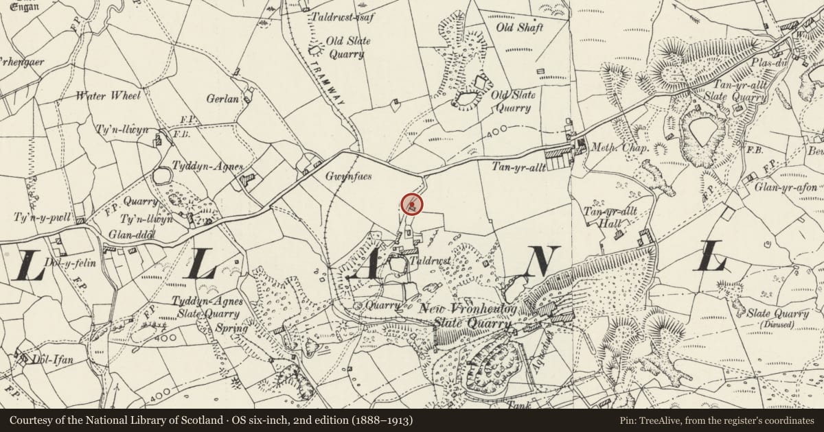
Slide toward Today to fade the historical sheet and see the modern map underneath.
David Rumsey Map Collection, Stanford LibrariesDavid Rumsey Map Collection, Stanford LibrariesDavid Rumsey Map Collection, Stanford LibrariesDavid Rumsey Map Collection, Stanford LibrariesLlyfrgell Genedlaethol Cymru – The National Library of Wales
5 historical maps cover this location, the earliest the 1795 map "To Sir Watkin Williams-Wynn Bart ... the map of the six counties of North Wales is most humbly inscribed by his obedient humble servant" (Llyfrgell Genedlaethol Cymru – The National Library of Wales).
Historical maps covering this location
- 1795 · To Sir Watkin Williams-Wynn Bart ... the map of the six counties of North Wales is most… (Llyfrgell Genedlaethol Cymru – The National Library of Wales)
- 1883 · Watershed map England, Wales 3. (David Rumsey Map Collection, Stanford Libraries)
- 1896 · Sheet 7. Ordnance Survey of England and Wales. (David Rumsey Map Collection, Stanford Libraries)
- 1899 · 118 Nevin (Hills) (David Rumsey Map Collection, Stanford Libraries)
- 1901 · Sheet 9 and 10. (David Rumsey Map Collection, Stanford Libraries)
Cadw's description
Location
Situated at the northern end of the farm at Taldrwst on a track leading south of Lon Dwr, approximately 1.5 km east of Llanllyfni.
History
C17 barn with eaves raised and new roof structure added in late C18 or early C19. The barn forms part of the farm at Taldwrst, the farmhouse and other farmbuildings of which are in too fragmentary a condition for inclusion on this list.
Exterior
Irregularly coursed rubblestone on boulder plinth; slate roof. Narrow opposing segmental-arched doorways with voussoirs and plank doors to long walls with small window to south on each side; upper-level doorway to south gable end.
Interior
3 A-frame trusses with double purlins and rafters, all lime plastered; lime torching to underside of slates and lime-plastered walls.
Reason for designation
Included as a very good example of a C17 barn, albeit with later alteration, a comparatively rare building type in this region and with fine if simple architectural detailing.
Nearby in the register
- Tyn-llwynDomesticunder 1 mi
- Caer EnganHillfortunder 1 mi
- Pant DuDomesticunder 1 mi
- Former Cowhouse to Dol-wenithAgriculture and Subsistenceunder 1 mi
Other entries of the same register within about three miles of this one, by straight line.