Cof Cymru: National Historic Assets of Wales · Wales
Former Cowhouse to Dol-wenith
Llanllyfni, Gwynedd, Wales
A Grade II listed building in Llanllyfni, Gwynedd, designated on 21 July 2000.
The record
- Designation
- Listed building, Grade II
- Broad class
- Agriculture and Subsistence
- Date of designation
- 21 July 2000
- Locality
- Llanllyfni
- Community
- Llanllyfni
- Unitary authority
- Gwynedd
- Country
- Wales
- Coordinates
- 53.04030, -4.27709
- Cadw reference
- 23662
Slide toward Today to fade the historical sheet and see the modern map underneath.
David Rumsey Map Collection, Stanford LibrariesDavid Rumsey Map Collection, Stanford LibrariesDavid Rumsey Map Collection, Stanford LibrariesDavid Rumsey Map Collection, Stanford LibrariesLlyfrgell Genedlaethol Cymru – The National Library of Wales
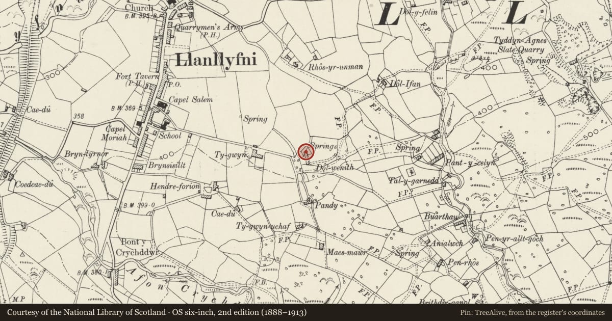
5 historical maps cover this location, the earliest the 1795 map "To Sir Watkin Williams-Wynn Bart ... the map of the six counties of North Wales is most humbly inscribed by his obedient humble servant" (Llyfrgell Genedlaethol Cymru – The National Library of Wales).
Historical maps covering this location
- 1795 · To Sir Watkin Williams-Wynn Bart ... the map of the six counties of North Wales is most… (Llyfrgell Genedlaethol Cymru – The National Library of Wales)
- 1883 · Watershed map England, Wales 3. (David Rumsey Map Collection, Stanford Libraries)
- 1896 · Sheet 7. Ordnance Survey of England and Wales. (David Rumsey Map Collection, Stanford Libraries)
- 1899 · 118 Nevin (Hills) (David Rumsey Map Collection, Stanford Libraries)
- 1901 · Sheet 9 and 10. (David Rumsey Map Collection, Stanford Libraries)
Cadw's description
Location
Situated immediately to the north of Dol-wenith.
History
Former cow-house, but perhaps adapted from the original dwelling at Dol-wenith; a photograph published in 1903 records an axial stack suggesting original domestic use. That this building is used to illustrate a book dedicated to the life and work of Robert Jones, suggests that it is this building, rather than the present house, which represents his birthplace. If that is so, perhaps it became a cow-house when the present house was built in the early C19; it was then remodelled again in the early C20, with much of the detail more recent again.
Exterior
Former cowhouse; roughly coursed rubblestone with slate roof. Single storeyed, long rectangular plan in 2 sections. Three C20 windows alternate with 2 C20 doors to front, all earlier openings. Lower section to left has corrugated iron roof.
Interior
Interior not inspected at time of Survey.
Reason for designation
Listed as an integral part of the farmstead group at Dol-wenith. The site is of historic interest for its association with Robert Jones.
Nearby in the register
- Pigsties at Dol-wenithAgriculture and Subsistenceunder 1 mi
- Dol-wenithDomesticunder 1 mi
- Maes MawrDomesticunder 1 mi
- 70 Ffordd Rhedyw (Rhedyw Road)Domesticunder 1 mi
Other entries of the same register within about three miles of this one, by straight line.